Hawke's Bay Trails: Wineries, Water and Coast Rides Guide
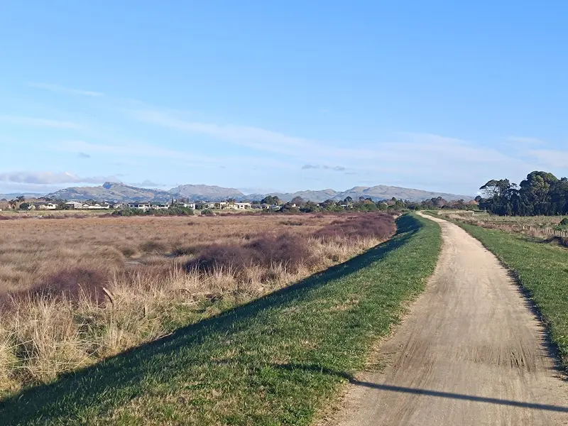
Photo: “Hawke's Bay landscape taken on walking trail in Clive June 2024” by Jakob (TheLoyalOrder), CC BY-SA 4.0, via Wikimedia Commons
Trail at a glance
- Type
- Great Ride
- Region
- Hawke's Bay
- Distance
- 177 km network
- Time
- 1 hr to several days
- Grade
- Grade 1–2 (easy)
- Bookings
- Not required
- Managed by
- Ngā Haerenga NZ Cycle Trail
Overview
The Hawke's Bay Trails are a 177 km network of dedicated cycle paths and quiet country roads. They trace the coast from Bay View to Cape Kidnappers and wander inland through vineyards, riverbanks and orchards around Napier and Hastings. The terrain is mostly flat (Grade 1–2), on a lime-sand surface, and the weather is famously kind, which makes them great for families, novices and wine-lovers.
The trails are designed for day rides. Themed routes (Water, Landscapes and Wineries) make it easy to plan anything from an hour's ride to several days.
Highlights
- Wine tastings and cellar-door dining in the Gimblett Gravels and around Bridge Pā
- Napier's art deco architecture and Marine Parade
- The Cape Kidnappers gannet colony, reached by guided tour from Clifton
- Te Mata Peak, the Hawke's Bay Farmers' Market, and wetlands full of birds
- The Ātea a Rangi star compass at Waitangi Regional Park
Popular rides
| Ride | Distance | Grade | Time |
|---|---|---|---|
| Wineries Ride | 36–47 km | 1 | 3–5 hr |
| Puketapu Loop (from Taradale) | 18 km | 1–2 | 1.5–3 hr |
| The Water Ride (from Ahuriri) | 35 km | 1 | 2–3 hr |
| Clive → Clifton | 15 km | 1–2 | 1–2 hr |
| Napier City Loop | up to 39 km | 2–3 | 2–4 hr |
| Marine Parade Explorer | up to 30 km return | 1 | 2–4 hr |
| Havelock North → Clive (return) | 37 km | 1–2 | 2–4 hr |
- Wineries Ride: About a dozen wineries line the route. Book tastings and meals ahead. Start at Roys Hill Reserve or Hastings Golf Club.
- Water Ride: Coast and wetlands, with around 70 bird species and viewing hides, plus Rorookuri Island, the site of a sacred pā.
- Clive → Clifton: Along the coast to Clifton, the gateway to Cape Kidnappers, Te Kauwae-a-Māui (Māui's fish hook). The gannets are there from October to March.
- Marine Parade: Suitable for bikes, trikes, wheelchairs and walkers. The only serious hills on the network are in the Tukituki valley.
Need to know
- E-bikes are allowed if they're under 300 W. The flat terrain is easy on batteries.
- Bikes: Anything from kids' bikes to tourers. Trikes, tandems and wheelchairs suit many sections, especially the 20 km waterfront from Bay View to Waitangi Regional Park.
- Shared trails: Keep left, ring your bell, and leave farm gates as you find them.
- Flooding: Low spots and underpasses at Awatoto and Ahuriri can flood at high tide.
- Dogs: On a lead where allowed. Not allowed in DOC areas, sensitive bird habitat or farmland with stock. Avoid the Water Ride section from Bay View past the airport to Prebensen Drive. Horses only where horse trails cross.
- Mobile coverage: Good across the network, with plenty of toilets.
Getting there
Napier Airport connects to regional New Zealand, and Auckland and Wellington are each under 5 hours' drive away. InterCity serves the main towns. Bike hire is available in Napier, Hastings, Taradale, Havelock North and other depots. Book tours and shuttles ahead for December to March.
Check before you go
Closures, slips, snow and booking changes happen often. Ngā Haerenga NZ Cycle Trail posts current alerts and bookings for the Hawke's Bay Trails on its official page.
Current alerts and bookings