Waitangi Regional Park: Ātea a Rangi Star Compass & Clive Estuary
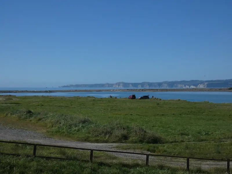
Photo: “Cape Kidnappers from near Waitangi Regional Park, March 2026 (4)” by Jakob (TheLoyalOrder), CC BY 4.0, via Wikimedia Commons
Park at a glance
- Region
- Hawke's Bay
- Location
- Awatoto to Haumoana coast
- Managed by
- Hawke's Bay Regional Council
- Dogs
- Check dog rules
- Camping
- No
Overview
Waitangi Regional Park runs about 5 km along the coast between Awatoto and Haumoana, covering 300 hectares of narrow coastline between Napier and Hastings. It links the mouths of the Tukituki, Ngaruroro and Tūtaekurī rivers and the Karamū Stream / Te Awa o Mokotūāraro (formerly the Clive River) with coastal reserves. It's a haven for wildlife and for people who love the water.
The Waitangi Estuary was an early arrival site for both Māori and Pākehā. Hawke's Bay Regional Council ranks Waitangi among the top 10 wetlands in the region for protection and enhancement. Restoration work, including a new 15-hectare wetland finished in 2019, is bringing back habitat for birds, fish and whitebait.
Ātea a Rangi Star Compass
On the edge of the coast stands Ātea a Rangi, a dramatic circle of carved pou, stones and a waharoa (gateway), installed in 2017 by the Ātea a Rangi Educational Trust. Local carvers created the pou to represent the points of the compass. Information signs explain how ancient Māori navigated the ocean to arrive here. Educational tours can be arranged through atea.nz.
Getting there
- Waitangi (northern end): From SH2, about 10 minutes from both Napier and Hastings, for the star compass and the estuary
- Clive: Through Evers-Swindell Reserve, for the cycle trail, BMX track, horse trail and boat ramp
- East Clive: Ferry Road and Richmond Road car parks, with foot access to the beach and wetland
- Haumoana: The Domain Road car park, for the Tukituki River mouth
- By bike: The Hawke's Bay Trails run through the park to Clifton and connect with Napier, Hastings and Pākōwhai Park.
Things to do
Birdwatching
Watch for white heron, royal spoonbill, godwits and gannets. Seals sometimes come inshore too. Across the road from the star compass, the Horseshoe Wetland is home to many wading birds. Reach it from the car park, under the bridges and along the stopbank.
On the water
The lower rivers are popular for fishing, whitebaiting, rowing, waka ama, kayaking, jet boating, jet skiing and kitesurfing. Hawke's Bay navigation safety bylaws limit some activities to specific zones in the Waitangi Estuary, Clive and Ngaruroro areas.
On Waitangi Day (6 February), a popular festival on the Te Awa o Mokotūāraro River includes a re-enactment of the arrival of the first European settlers.
Rules and facilities
- No vehicles along the coast at East Clive between the Tukituki Estuary and the Ngaruroro River mouth, to protect nesting birds and the beach crest. You can walk through, but watch your step and don't disturb birds or seals.
- Parts of the park are wāhi tapu. Commercial tours and events need approval.
- No toilets in the park. The nearest are at Evers-Swindell Park in Clive.
- The parking areas can be remote, so lock your car and take your valuables with you.
- Hawke's Bay Regional Council doesn't publish dog rules for this park, so check the signs on arrival.
Where is Waitangi Regional Park?
The pin marks: Centre of the park area (-39.5641, 176.9224). It isn't an entrance or car park, so check the council's park page for access points before you go. Plan a route on OpenStreetMap (opens in a new tab).
Location data: OpenStreetMap contributors (ODbL 1.0).
Check before you go
Track closures, gate times, fire bans and storm damage change often. Hawke's Bay Regional Council posts current alerts for Waitangi Regional Park on its official park page.
Current park alerts