Whakarewarewa Forest Loop: Rotorua Redwoods Great Ride
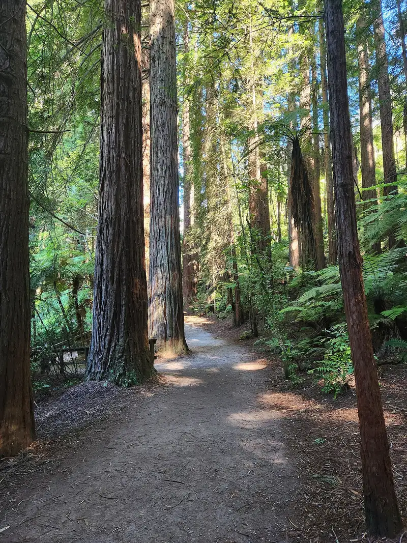
Photo: “Redwoods Forest Rotorua 35” by Panamitsu, CC BY-SA 4.0, via Wikimedia Commons
Trail at a glance
- Type
- Great Ride
- Region
- Bay of Plenty
- Distance
- About 33 km loop
- Time
- 3–5 hr
- Grade
- Grade 2–3
- Bookings
- Not required
- Managed by
- Ngā Haerenga NZ Cycle Trail
Overview
The Whakarewarewa Forest Loop is the newest Ngā Haerenga Great Ride. It's purpose-built to show off Whakarewarewa Forest, also known as the Redwoods, about 10 minutes from central Rotorua. The loop is a sightseeing tour of roughly 33 km taking 3–5 hours, with giant Californian coastal redwoods, native forest, views over Lake Rotorua and Lake Tikitapu, steam vents and bubbling mud.
It's mostly Grade 2 (easy), with a couple of short Grade 3 sections, so it suits confident riders of almost all ages and fitness levels. Storyboards and the trail app share the forest's volcanic past, Māori history and the planting of the redwoods. The wider forest has around 200 km of trails if you want more.
Highlights
- Towering redwoods, lush ferns and native trees
- Views over Rotorua's volcanic lakes
- Te Pūtake o Tawa hub, with food, coffee and five taonga by local Tūhourangi artists
- The Redwoods Treewalk and visitor centre, an easy detour
- Swimming, a campground and ice cream at Tikitapu
- The Waipa MTB hub, with bike hire, showers, a beer garden and hot tubs
Loop sections
| Section | Distance | Grade | Time |
|---|---|---|---|
| Te Pūtake o Tawa → Te Ara Ahi (via Tikitapu) | 14 km | 2–3 | 1–2.5 hr |
| Te Ara Ahi ("the Pathway of Fire") | 8.5 km | 2 | 30 min |
| Waipa car park → Te Pūtake o Tawa | 10.5 km | 2 | 1–2 hr |
- Start at Te Pūtake o Tawa on the road to Tikitapu, or at the Waipa MTB hub on Waipa State Mill Road. You can also ride out from town on Te Ara Ahi.
- The forest near Tikitapu regrew after the 1886 Mt Tarawera eruption buried the original forest under 3 m of ash. Look for obsidian along the Tūhua section.
- Lake Rotokākahi is private for cultural reasons, so follow the signs and stay off its shore.
- The loop's longest climb, at Te Pikitanga ki Whangapipiro, past a bubbling mud pool, only lasts a couple of minutes.
Family-friendly loops
| Ride | Distance | Grade | Time |
|---|---|---|---|
| Waipa–Dipper Loop | 5–6.5 km | 2 | 2–3 hr |
| Titokorangi Loop (from the visitor centre) | 8.5 km | 2–3 | 2–3 hr |
| Tikitapu Loop | 8.5–14.5 km | 2 | 1.5–2 hr |
Need to know
- Bike: A mountain bike or e-MTB. You can hire one at Waipa, Te Pūtake o Tawa or in town.
- Surface: Fine gravel and volcanic pumice that drains freely, so it's rideable year-round. The canopy gives shelter from sun and wind.
- Food: At Te Pūtake o Tawa, Tikitapu and Waipa. The first two may close midweek or in winter, but the Tikitapu camp store is always open. There are four water refill stations.
- Emergencies: The Rotorua MTB club first-aid line is 0800 942 521. Coverage can be patchy around Tikitapu.
- Dogs: Allowed on a lead. No horses.
Getting there
Rotorua Airport has domestic flights, and Auckland is under 4 hours' drive. InterCity serves Rotorua. Book accommodation ahead for December to March.
Route map
The line shows the Whakarewarewa Forest Loop as mapped in OpenStreetMap. It measures about 34.1 km, against an official distance of About 33 km loop. Use it to see where the route goes. It isn't for navigation, so carry the official map and check track status with Ngā Haerenga NZ Cycle Trail (opens in a new tab) before you set out.
Location data: OpenStreetMap contributors (ODbL 1.0).
Check before you go
Closures, slips, snow and booking changes happen often. Ngā Haerenga NZ Cycle Trail posts current alerts and bookings for the Whakarewarewa Forest Loop on its official page.
Current alerts and bookings