Waikato River Trails: Karapiro to Atiamuri Great Ride Guide
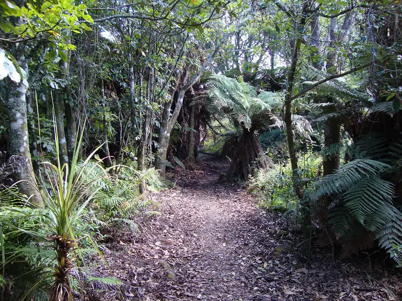
Photo: “Waikato River Trails01” by Schwede66, CC BY-SA 3.0, via Wikimedia Commons
Trail at a glance
- Type
- Great Ride
- Region
- Waikato
- Distance
- 103 km
- Time
- 2–4 days
- Grade
- Grade 3–4
- Bookings
- Not required
- Managed by
- Ngā Haerenga NZ Cycle Trail
Overview
The Waikato River Trails follow the mighty Waikato River through the North Island's rural heartland, past a chain of hydro dams and lakes built between 1924 and 1966. Along the way you'll find exotic and native forest, wetlands, riverside reserves, volcanic outcrops, suspension bridges and small villages with welcoming cafés.
The trail is 103 km in five sections, each named for the lake it follows, and takes 2–4 days in full. It's mostly smooth but ranges from intermediate to advanced, so it suits reasonably fit riders with some off-road experience. Most people ride it as day trips.
Current closures (2026)
- Arapuni Dam: Arapuni Road across the dam is closed from 1 September 2026 for 24–36 months for remedial works. A new trail section takes users between the Arapuni Swingbridge and Jones Landing around the worksite, but cyclists can't use the Powerhouse Road vehicle detour. Riding between Arapuni and Waipapa Dam needs vehicle support.
- Waipapa Dam → Mangarewa Bridge: This stretch is still closed after storm damage in February.
Highlights
- The Arapuni Suspension Bridge, 152 m long and more than 50 m high, built in the 1920s
- Mid-century hydro dams and power stations, with interpretation panels
- The Huihuitaha wetland boardwalk (500 m)
- Pōhaturoa Rock (520 m) near Atiamuri
- Riverside reserves for picnics, swimming and camping
Trail sections
| Section | Distance | Grade | Time |
|---|---|---|---|
| Karapiro (Pokaiwhenua Bridge → Arapuni) | 11.5 km | 3 | 1–2 hr |
| Arapuni (Arapuni → Waipapa Dam, now on country roads) | 34.6 km | 4 | 3–4 hr |
| Waipapa (Waipapa Dam → Mangakino) | 19.6 km | 4 | 2–3 hr |
| Maraetai (Mangakino → Whakamaru Dam) | 12.3 km | 3 | 1–2 hr |
| Whakamaru (Whakamaru Dam → Atiamuri) | 26 km | 3 | 2–4 hr |
The Arapuni section now follows signposted country roads on the western side of the river, with some long, steep climbs. Once you start the Waipapa section, there's no way off for 2–3 hours.
Day rides
| Ride | Distance | Grade | Time |
|---|---|---|---|
| Arapuni → Lake Karapiro (return) | 23 km | 3 | 2–3 hr |
| Mangakino → Whakamaru (return) | 24 km | 3 | 2–4 hr |
| Arapuni → Jones Landing | 4 km one way | 4 | 1–2 hr return |
The Karapiro ride starts with brunch at Arapuni's Rhubarb Café and a wobbly crossing of the suspension bridge.
Need to know
- Bike: A mountain bike is recommended, though hybrids are fine on the flatter on-road sections. E-bikes are allowed, and e-MTBs suit the terrain best.
- Weather: Rideable year-round, but muddy in places in winter.
- Food and water: Small shops and taps in Arapuni, Mangakino and Whakamaru.
- Mobile coverage: Reasonable on most sections, but patchy on Arapuni and Waipapa.
- Dogs: Not allowed, out of respect for neighbouring farmers. No horses.
Getting there
The trails are just off SH1 near Putāruru and Tokoroa, close to Hamilton, Rotorua and Taupō, and about 2–3 hours from Auckland. You can hire bikes in Arapuni and Mangakino. Council campsites include Jones Landing, Little Waipa, Dunham's Point, Whakamaru and Mangakino Lakefront. Village accommodation is limited, so book ahead.
Check before you go
Closures, slips, snow and booking changes happen often. Ngā Haerenga NZ Cycle Trail posts current alerts and bookings for the Waikato River Trails on its official page.
Current alerts and bookings