St James Cycle Trail: High-Country Mountain Biking Near Hanmer Springs
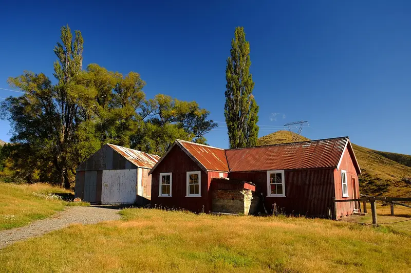
Photo: “St James Station” by Francis Vallance (Heritage Warrior), CC BY 2.0, via Wikimedia Commons
Trail at a glance
- Type
- Great Ride
- Region
- Canterbury
- Distance
- About 59 km
- Time
- 1–2 days
- Grade
- Grade 3–4 (some 5)
- Bookings
- Hut tickets for Lake Guyon
- Managed by
- Ngā Haerenga NZ Cycle Trail
Overview
The St James Cycle Trail is a challenging high-country ride through the vast St James Conservation Area, near Hanmer Springs. It was an important travel route for early Māori. Later the land became St James Station, a 78,000-hectare high-country farm dating back to 1862 and once one of New Zealand's largest. DOC took it over in 2008.
The trail runs through broad river valleys flanked by rugged ranges, past golden meadows, beech forest, clear rivers, hidden lakes and rustic huts. The four sections cover about 59 km. Fit riders can finish in one long 6–9 hour day, but a two-day trip is highly recommended.
Highlights
- Big mountain views and pastoral high-country history
- Lake Guyon, with its mirror-like water and old hut
- Wild horses grazing the river flats
- Cow Stream hot springs, a 10-minute detour off the Edwards Valley track
- Remote huts, starry skies and real solitude
Trail sections (Maling Pass → Homestead, recommended)
| Section | Distance | Grade | Time |
|---|---|---|---|
| Maling Pass car park → Waiau 4WD road end | 12 km | 3–4 | 1–1.5 hr |
| Waiau 4WD road end → Saddle Spur Bridge | 15.5 km | 3 | 1.5–2.5 hr |
| Saddle Spur Bridge → Scotties Hut | 14.5 km | 4–5 | 2–3 hr |
| Scotties Hut → St James Homestead | 17 km | 3 | 1.5–2.5 hr |
- Maling Pass (1,308 m) is the high point, reached after a 250 m climb past glimpses of Lake Tennyson.
- The Lake Guyon side trip adds about 5 km.
- Saddle Spur → Scotties is the hardest section: 240 m of climbing on rocky, uneven ground, with drop-offs and thorny matagouri. You'll push in places, including over Charlies Saddle.
- The Edwards Valley has four unbridged stream crossings before Peters Pass and the run down to the Homestead.
Starting at Maling Pass gives more downhill and favourable winds. Most riders take a shuttle to Maling. Riding from the Homestead along Tophouse Road adds about 25 km.
Day rides
| Ride | Distance | Grade |
|---|---|---|
| Homestead Run Loop (via Peters Valley) | 15 km | 3 |
| Homestead → Cow Stream hot springs (return) | 32 km | 3–4 |
The Homestead Run Loop is a good option in winter and for riders who want a taste of the area.
Season and safety
- Ridden November to April or May. From June to October, winter conditions often make it inaccessible. Spring brings the alpine meadows into flower.
- This is a remote alpine environment with weather extremes, flooding rivers and avalanches. Check conditions with DOC, tell someone your plans, and carry food for an unplanned night if rivers might rise.
- No mobile coverage past Jacks Pass. Carry a personal locator beacon, which you can hire in Christchurch but not in Hanmer.
Huts, camping and gear
- Huts: Lake Guyon (standard: $5 per adult and $2.50 per youth per night, with hut tickets from DOC or the Hanmer Springs i-SITE), plus Pool and Scotties (basic and free, first come first served). Camping areas and toilets are at the Homestead, Lake Tennyson and other points.
- Bike: A high-quality mountain bike and a tool kit. E-MTBs are allowed, but the trail is near the limit of many batteries, there's no charging, and you may have to lift or push.
- Food: None on the trail, so carry everything. Treat stream water.
- Dogs and horses: Allowed in the conservation area. Keep dogs under control and out of huts.
Getting there
The St James Homestead car park is about 13 km from Hanmer Springs over Jacks Pass, a narrow, winding gravel road. Hanmer has shuttles and bike hire, and is about 2 hours from Christchurch Airport. Book ahead for January to April.
Route map
The line shows the St James Cycle Trail as mapped in OpenStreetMap. It measures about 62.5 km, against an official distance of About 59 km. Use it to see where the route goes. It isn't for navigation, so carry the official map and check track status with Ngā Haerenga NZ Cycle Trail (opens in a new tab) before you set out.
Location data: OpenStreetMap contributors (ODbL 1.0).
Check before you go
Closures, slips, snow and booking changes happen often. Ngā Haerenga NZ Cycle Trail posts current alerts and bookings for the St James Cycle Trail on its official page.
Current alerts and bookings