Rangitoto Summit Track: Climb Auckland's Youngest Volcano
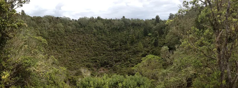
Photo: “Rangitoto Crater NZ” by MurielBendel, CC BY-SA 4.0, via Wikimedia Commons
Trail at a glance
- Type
- Day walk
- Region
- Auckland
- Distance
- 7 km return
- Time
- 2 hr return
- Grade
- Easy to intermediate
- Bookings
- Ferry bookings only
- Managed by
- Department of Conservation
Overview
Rangitoto is Auckland's youngest and biggest volcano. It erupted from the sea about 600 years ago, and it's now home to the world's largest pōhutukawa forest. The Rangitoto Summit Track climbs from the ferry wharf over black lava fields to the summit lookout, with panoramic views of Auckland / Tāmaki Makaurau and the Hauraki Gulf / Tīkapa Moana.
It's 7 km return (about 2 hours), rated easy to intermediate, with 250 m of climbing over rough volcanic rock.
The walk
- Pass through the waharoa (carved gateway) at Rangitoto Wharf, which represents the ancestor Peretū. The track starts just past the historic Scouts bach.
- Climb through lava fields and pōhutukawa forest. Expect loose gravel and little shade.
- A viewing platform at the Crater Rim Track junction looks into the 60 m-deep crater.
- Two minutes on is Summit Lookout, with seating and a historic fire command post from Auckland's military defences (1935–1957).
- Return the same way.
Side trips:
| Track | Time | Notes |
|---|---|---|
| Crater Rim Track | 20 min loop (850 m) | Circles the crater, with military remnants |
| Lava Caves Track | 15 min one way (500 m) | Dark, low tunnels. Bring a torch. Great for kids. |
| Wilson's Park Track | 1 hr one way (1.4 km) | Longer alternative route with more shade |
Getting there
Rangitoto can only be reached by ferry, boat or kayak.
- Ferry: 25 min from Queens Wharf in downtown Auckland, or 20 min from Devonport. Leave plenty of time to get back for your return ferry.
- Kayak: About 2 hours from Devonport or Takapuna for experienced paddlers. Guided tours are available.
- Private boats can drop off at Rangitoto or Islington wharves, but can't moor there.
What to bring
- 1–2 litres of water each. There's no food or drinking water on the island.
- Sun protection, because the black rock reflects intense heat, plus warm and waterproof layers
- Sturdy shoes with good grip, and a torch for the lava caves
Rules and safety
- Rangitoto has been pest-free since 2011. Check, clean and seal your gear before you go.
- Total fire ban: no fires, cigarettes, BBQs or cookers.
- No camping (historic baches can be booked through the Rangitoto Island Historic Conservation Trust). No bins, no dogs, no drones.
- There are toilets at the wharf and near the summit, but none are accessible. Mobile coverage is patchy. Watch out for wasps.
When to go
Visit in December and early January to see the pōhutukawa forest in bloom. Listen for tīeke (saddleback), kākā and kākāriki, which are rare on the mainland.
Name and history
Rangitoto's full name is Te Rangi-i-totongia-ai-te-ihu-o-Tamatekapua, "the day the blood of Tamatekapua was shed". It refers to a battle at Islington Bay involving Tamatekapua, chief of the Te Arawa waka.
Check before you go
Closures, slips, snow and booking changes happen often. Department of Conservation posts current alerts and bookings for the Rangitoto Summit Track on its official page.
Current alerts and bookings