Queenstown Trail: Lake Wakatipu, Arrowtown and Gibbston Rides
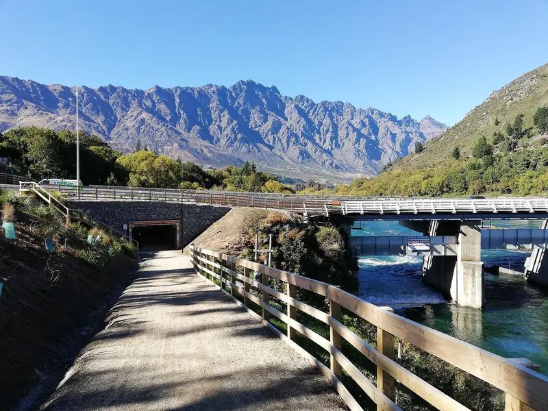
Photo: “Queenstown Trail Frankton” by André Richard Chalmers, CC BY-SA 4.0, via Wikimedia Commons
Trail at a glance
- Type
- Great Ride
- Region
- Otago
- Distance
- 110+ km network
- Time
- Day rides or multi-day
- Grade
- Grade 2–3 (some 4)
- Bookings
- Book shuttles ahead
- Managed by
- Ngā Haerenga NZ Cycle Trail
Overview
The Queenstown Trail threads through the Wakatipu Basin, surrounded by sheer mountain ranges, on lakeside paths, country lanes, quiet roads and cross-country cycleways. It links Queenstown, Arrowtown and the Gibbston Valley, with gold-rush history, suspension bridges, bungy and jet boats, ice cream and cellar doors along the way.
The network is made up of named trails totalling more than 110 km, mostly Grade 2–3 on smooth gravel, with harder riding around Jack's Point. Link them into a multi-day tour, or pick a single trail for a day ride.
The trails
| Trail | Distance | Grade | Time |
|---|---|---|---|
| Frankton Track & Kelvin Peninsula Trail | 15 km | 2 | 1–2 hr |
| Wharehuanui Trail (Arthurs Point → Arrowtown) | 13 km | 2 | 2–2.5 hr |
| Shotover Gorge Trail | 6.8 km | 3 | 1–1.5 hr |
| Twin Rivers Trail (Frankton → Morven Ferry) | 18.5 km | 3 | 2–3 hr |
| Countryside Trail (Arrowtown ↔ Frankton) | 13.5 km | 3 | 2–3 hr |
| Jack's Point Trail | 12 km | 4 | 2–3 hr |
| Lake Hayes Trail | 8 km | 3 | 1 hr |
| Arrow River Bridges Trail | 16 km | 2 | 2–3 hr |
| Gibbston River Trail | 9 km | 2 | 2 hr |
Highlights:
- Frankton Track: Starts at the Queenstown Gardens and follows the lakeshore under the Remarkables. Ideal for families and novices.
- Shotover Gorge Trail: Through the historic Hugo Tunnel and across the Kimi-ākau bridge, with jet boats roaring below. It has steep sections and tight corners.
- Lake Hayes: Known as New Zealand's most-photographed lake.
- Arrow River Bridges: From gold-rush Arrowtown across the 80 m Edgar Suspension Bridge to the historic Kawarau Bridge, the world's original bungy site.
- Gibbston River Trail: Through the "Valley of the Vines", past cellar doors such as Peregrine and Gibbston Valley.
Day rides
| Ride | Distance | Grade | Time |
|---|---|---|---|
| Arrowtown → Gibbston Valley | 23 km | Easy–intermediate | ~5 hr |
| Queenstown → Jack's Point | 27 km | Easy–advanced | 5–6 hr |
| Queenstown → Gibbston | 40 km | Easy–intermediate | 6–8 hr |
Need to know
- Bike: A front- or full-suspension mountain bike with rugged tyres is recommended. E-bikes are allowed.
- Queenstown sits at the lowest point of the basin, so every ride from town involves some climbing. The wind matters too, so ask locals where to ride.
- Weather: Hot and dry in summer, icy in winter, and changeable at any time.
- Food: Plenty of cafés, wineries and taverns, but book restaurants in summer and carry snacks for the gaps.
- Mobile coverage: Good across the network.
- Dogs: Allowed under control, following QLDC dog rules. Horses only on approved shared sections.
Getting there
Queenstown Airport sits near the middle of the network. You can hire bikes in Queenstown, Frankton, Arrowtown and Gibbston, and many places to stay have their own. Shuttles don't run to a schedule, so book ahead, especially from December to April.
Check before you go
Closures, slips, snow and booking changes happen often. Ngā Haerenga NZ Cycle Trail posts current alerts and bookings for the Queenstown Trail on its official page.
Current alerts and bookings