Queen Charlotte Track: Marlborough Sounds Bike and Walk Guide
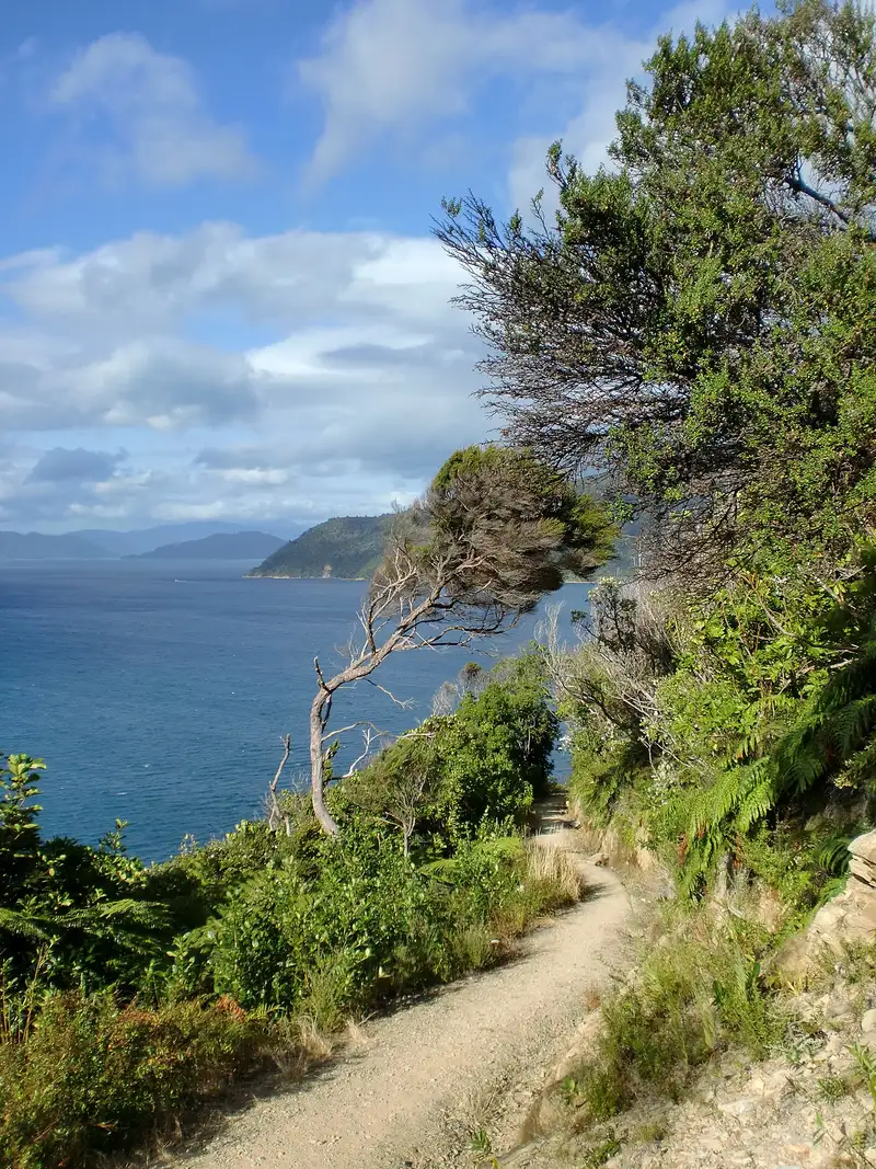
Photo: “2013 03 09 Queen Charlotte Track 15km (20)” by Millie9001, CC BY-SA 4.0, via Wikimedia Commons
Trail at a glance
- Type
- Great Ride
- Region
- Marlborough
- Distance
- 73.5 km
- Time
- 2–3 days
- Grade
- Grade 3–4 (some Grade 5)
- Bookings
- QCTLC pass and boats required
- Managed by
- Ngā Haerenga NZ Cycle Trail
Overview
The Queen Charlotte Track follows the ridges and bays of the Marlborough Sounds for 73.5 km, from historic Meretoto / Ship Cove to Anakiwa. You reach the start by a scenic water taxi from Picton. Campsites, lodges and resorts dot the bays, and boat operators shuttle luggage between them, so you can ride with just a daypack. Swimming, kayaking and wildlife cruises add to the trip.
Seasoned riders take 2–3 days. It's one of New Zealand's oldest mountain biking adventures. Much of it is Grade 3 (intermediate), with technical Grade 4 sections and a few Grade 5 climbs, so it's best for reasonably fit, experienced mountain bikers.
Highlights
- Magnificent Marlborough Sounds views from the ridgelines, including Eatwell's Lookout
- Sweet-smelling coastal forest, with birdlife thriving thanks to pest trapping
- Meretoto / Ship Cove, where Captain Cook landed in 1770 and the first sustained contact between Māori and Europeans took place
- Waterside resorts, swimming, and bike–cruise–kayak combinations
Track sections
| Section | Distance | Grade | Time |
|---|---|---|---|
| Meretoto / Ship Cove → Camp Bay | 30 km | 3–4 | 4–6 hr |
| Camp Bay → Torea Saddle | 23 km | 3–5 | 4–5 hr |
| Torea Saddle → Anakiwa | 20.5 km | 3–5 | 4–5 hr |
- Ship Cove → Camp Bay: A gentler climb out of the cove since a 2019 realignment, then mostly flat, wide track around Endeavour Inlet. DOC's Camp Bay campsite and nearby lodges are popular overnight stops.
- Camp Bay → Torea Saddle: About 900 m of climbing along the ridge between Queen Charlotte and Kenepuru sounds, often hot and hard work. Some gradients between Kenepuru Saddle and Bay of Many Coves reach Grade 5. Easier option: ride the quiet sealed road from Kenepuru Saddle to Portage.
- Torea Saddle → Anakiwa: A brutal opening climb, which many people push, then views from the tops, an optional detour to Mistletoe Bay, and an easy cruise around the Grove Arm.
Getting back: Take the boat from Anakiwa to Picton, or ride the Link Pathway to Picton (26 km, 2.5–4 hr) or to Havelock (20 km).
Passes and rules
- QCTLC Track Pass: Required to ride between Camp Bay and Anakiwa, which crosses private land. Buy it from selected operators or the Queen Charlotte Track Landowners Co-operative.
- Summer bike rule: From 1 December to 28 February, bikes riding the Ship Cove → Camp Bay section must take the 8am boat to Ship Cove.
- Dogs and horses: Not allowed.
Day rides
| Ride | Distance | Grade |
|---|---|---|
| Anakiwa → Davies / Umungata Bay (return) | 4 km | Easy |
| Torea Saddle → Anakiwa | 20.5 km | Intermediate–advanced |
| Camp Bay → Torea Saddle | 24.5 km | Intermediate–advanced |
Need to know
- Bike: A well-maintained mountain bike is essential. Carry tools. E-bikes are allowed, but they're hard to push up the steepest climbs.
- Water: Supplies are limited, especially in dry summers, so fill up from reliable sources each morning. Picton is the place to stock up.
- Mobile coverage: Patchy from Ship Cove to Camp Bay, and reasonable after that.
- Weather: Good riding year-round. The track gets busy from January to April.
- Road access: Vehicle access via Kenepuru Road has reopened after storm damage, but expect one-lane sections and delays.
Getting there
Picton is the gateway, reached by the interisland ferry from Wellington. Blenheim Airport is 20 minutes away, Nelson 2 hours and Christchurch about 5 hours. Water taxis run from Picton marina. Book accommodation and boats well ahead for January to April. Check DOC's website for track status.
Route map
The line shows the Queen Charlotte Track as mapped in OpenStreetMap. It measures about 68.7 km, against an official distance of 73.5 km. Use it to see where the route goes. It isn't for navigation, so carry the official map and check track status with Ngā Haerenga NZ Cycle Trail (opens in a new tab) before you set out.
Location data: OpenStreetMap contributors (ODbL 1.0).
Check before you go
Closures, slips, snow and booking changes happen often. Ngā Haerenga NZ Cycle Trail posts current alerts and bookings for the Queen Charlotte Track on its official page.
Current alerts and bookings