Pouākai Crossing: Taranaki's Epic Alpine Day Hike
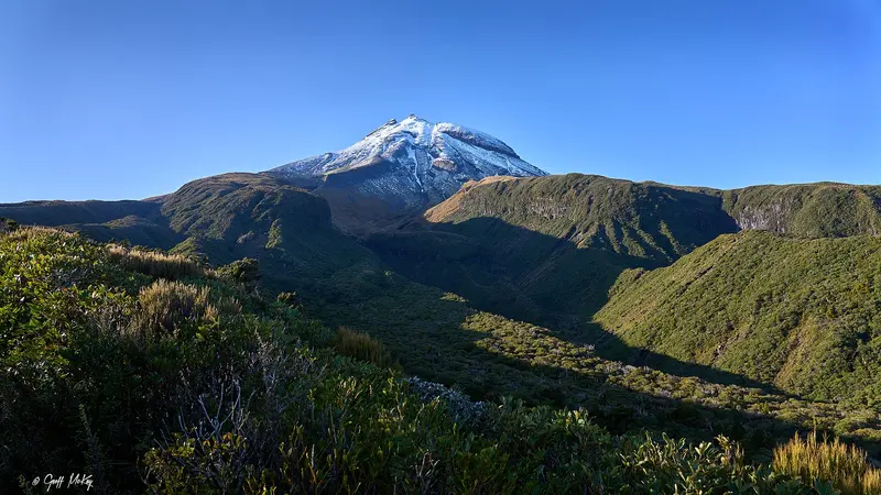
Photo: “Mount Taranaki - Pouakai Crossing (3)” by Geoff McKay, CC BY 2.0, via Wikimedia Commons
Trail at a glance
- Type
- Day walk
- Region
- Taranaki
- Distance
- 19 km one way
- Time
- 7.5–9.5 hr
- Grade
- Advanced tramping track
- Bookings
- Not required
- Managed by
- Department of Conservation
Overview
The Pouākai Crossing is a 19 km, one-way alpine day hike across the lower slopes of Taranaki Maunga in Te Papa-Kura-o-Taranaki (formerly Egmont National Park). It's the day-walk version of the 2–3 day Pouākai Circuit. Expect towering lava cliffs, a mighty waterfall, a unique alpine swamp, and, on a fine day, Taranaki reflected in the Pouākai tarns.
It takes 7 hr 30 min to 9 hr 30 min and is an advanced tramping track. This is a backcountry tramp, rough, muddy, wet or icy in places, so you need good fitness and the right gear.
Route (North Egmont → Mangorei Road)
There's less climbing if you walk from the North Taranaki Visitor Centre to Mangorei Road.
| Section | Time |
|---|---|
| North Taranaki Visitor Centre → Holly Hut | 3–4 hr |
| Holly Hut → Pouākai tarns | 2 hr |
| Pouākai tarns → Pouākai Hut | 20 min |
| Pouākai Hut → Mangorei Road end | 2 hr |
Highlights:
- Ambury Monument and the Dieffenbach Cliffs, towering lava columns. Cross the Boomerang Slip rockfall zone without stopping, one person at a time.
- Te Rere-o-Tahurangi Falls, a 31 m waterfall (1 hr return side trip from Holly Hut)
- The Ahukawakawa swamp boardwalk, with plants found nowhere else in the world
- The Pouākai tarns and their mirror view of the maunga. Stay on the boardwalk and don't enter the pools.
- Pouākai Trig (1,440 m), a 1 hr 30 min return side trip on a fine day
- "Goblin forest" of mossy kāmahi on the descent to Mangorei Road
Decision points: Check the weather at the lookout 10 minutes past the Holly Hut junction, and at the Kōkōwai Track junction if you're walking the other way. If you can't see the maunga or aren't equipped, turn back.
Transport and parking
- It's a one-way track, so book a shuttle or arrange your own transport.
- North Egmont parking is limited until December 2026 while the new visitor centre is built. Carpool or use a shuttle, and watch for trucks. The visitor centre is temporarily in the upper car park.
- No freedom camping at North Egmont. You can camp overnight at the Stratford Plateau or Mangorei Road car parks.
- From Inglewood, take SH3 west, then Lepper Road Upper, then Egmont Road to the end (about 18 km).
Safety
- Weather on the maunga changes fast, and many streams are unbridged and can rise quickly. Minarapa Stream near Holly Hut can become impassable after heavy rain.
- Winter: You'll need an ice axe, crampons, snow gaiters and goggles between North Egmont and Holly Hut, plus avalanche gear if there's snow risk.
- Carry a torch and consider a distress beacon, which you can hire at the visitor centre, as there are gaps in mobile coverage.
- The springs along the track are significant to iwi. Don't wash in them or walk through them.
Easier option
You can visit the Pouākai tarns on a much easier day walk from Mangorei Road.
Good to know
No dogs.
Route map
The line shows the Pouākai Crossing as mapped in OpenStreetMap. It measures about 19.9 km, against an official distance of 19 km one way. Use it to see where the route goes. It isn't for navigation, so carry the official map and check track status with Department of Conservation (opens in a new tab) before you set out.
Location data: OpenStreetMap contributors (ODbL 1.0).
Check before you go
Closures, slips, snow and booking changes happen often. Department of Conservation posts current alerts and bookings for the Pouākai Crossing on its official page.
Current alerts and bookings