Mount Manaia Track: Whangārei Heads Summit Walk
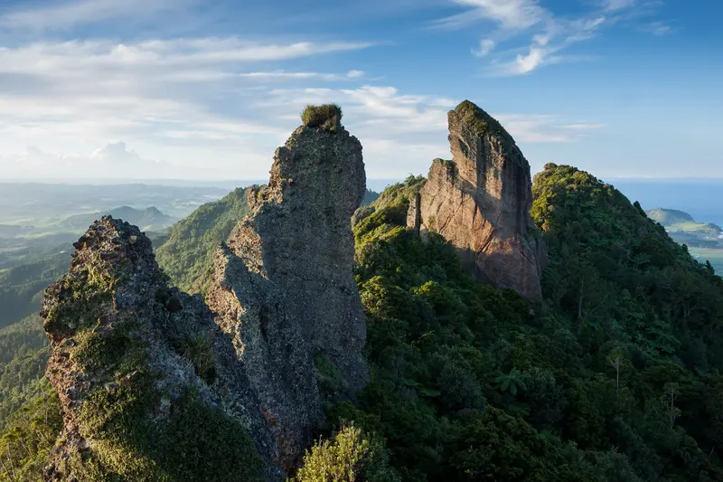
Photo: “Mt Manaia Ridge” by Jackson, CC0, via Wikimedia Commons
Trail at a glance
- Type
- Day walk
- Region
- Northland
- Distance
- 4 km return
- Time
- 2 hr return
- Grade
- Easy to intermediate
- Bookings
- Not required
- Managed by
- Department of Conservation
Overview
Mount Manaia rises in a cluster of jagged, bush-covered peaks above Whangārei Heads, 28 km east of Whangārei. A steep 4 km return (about 2 hours) climb through regenerating bush, nīkau and kauri leads to the summit area at 420 m. You look down on the entrance to Whangārei Terenga Paraoa (Whangārei Harbour), which DOC calls one of the most dramatic harbour entrances in Aotearoa.
From the lookout you can see Te Whara / Bream Head, Taranga and the Marotere (Hen and Chicken) Islands.
A sacred mountain
Mount Manaia is wāhi tapu for Ngātiwai and other iwi and hapū of Northland. Manaia is the tūpuna (ancestor) and chief of Ngātiwai. The craggy peaks represent his family, turned to stone through karakia in a dispute over his wife's infidelity. Please respect the mountain and stay on the marked track.
The track
- Distance: 4 km return
- Time: About 2 hours
- Elevation change: About 324 m
- Surface: A wide gravel path and many wooden steps
- Fitness: Moderate, with a steep climb
- Grade: Easy to intermediate walking track
The track winds under nīkau palms and kauri stands, with northern rātā hanging from pōhutukawa. It gets steeper and the views get better as you climb.
Safety
The natural rock lookout at the top has no safety barriers and very little space, and a fall from its edge could be fatal. Stay back from the edge, keep children close, and take extra care in wet and windy weather.
Getting there
Park in the Mount Manaia Club's lower car park on Whangārei Heads Road, above McLeod Bay. The track starts just above the car park.
Good to know
- No dogs and no drones
- Protect kauri: Scrub your shoes at the cleaning station and stay on the track.
Route map
The line shows the Mount Manaia Track as mapped in OpenStreetMap. It measures about 1.8 km, against an official distance of 4 km return. Use it to see where the route goes. It isn't for navigation, so carry the official map and check track status with Department of Conservation (opens in a new tab) before you set out.
Location data: OpenStreetMap contributors (ODbL 1.0).
Check before you go
Closures, slips, snow and booking changes happen often. Department of Conservation posts current alerts and bookings for the Mount Manaia Track on its official page.
Current alerts and bookings