Lake Waikaremoana Great Walk: Te Urewera Guide, Huts & Water Taxis
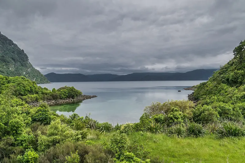
Photo: “Lake Waikaremoana 01” by Krzysztof Golik, CC BY-SA 4.0, via Wikimedia Commons
Trail at a glance
- Type
- Great Walk
- Region
- East Coast / Hawke's Bay
- Distance
- 46 km one way
- Time
- 3–4 days
- Grade
- Intermediate tramping track
- Bookings
- Huts and campsites must be booked year-round
- Managed by
- Te Uru Taumatua (Ngāi Tūhoe) & DOC
Overview
The Lake Waikaremoana Great Walk is a 46 km, one-way, 3–4 day walk around the shores of Lake Waikaremoana, the "sea of rippling waters", in Te Urewera, inland from Wairoa. It's more of a backcountry, off-the-beaten-track experience than most Great Walks, with giant podocarps, quiet beaches and the big views from Panekire Bluff.
This is the homeland of Ngāi Tūhoe. Te Urewera is the ancestor of the Tūhoe people, and in 2014 it became the first natural feature in New Zealand to be recognised in law as a legal person. It's governed by its own board. Te Uru Taumatua, Ngāi Tūhoe's operational entity, cares for the tracks and huts, and Tūhoe wardens staff the main huts in peak season.
Suggested 4-day itinerary (from Onepoto)
| Day | Section | Time | Distance |
|---|---|---|---|
| 1 | Onepoto → Panekire Hut | 4–6 hr | 8.8 km |
| 2 | Panekire Hut → Waiopaoa Hut | 3–4 hr | 7.6 km |
| 3 | Waiopaoa Hut → Marauiti Hut (via Korokoro) | ~4.5 hr | 12.1 km |
| 4 | Marauiti Hut → Hopuruahine Landing | ~6.5 hr | 15.7 km |
Day 1 is the hardest: a steady climb past the old Armed Constabulary redoubt to Panekire Bluff and Puketapu Trig (1,180 m). Tank water can run low in summer. Day 2 drops steeply off the range into beech and podocarp forest. On Day 3, take the Korokoro Falls side trip (1 hr return), which DOC calls a must-see. At dusk, walk out on the Puketukutuku Peninsula to listen for kiwi. Day 4 follows the lakeshore and the Whanganui arm to the Hopuruahine suspension bridge.
You can walk in either direction. Plan to be on the Panekire Range on your best-weather day.
Huts and campsites
There are four huts and five campsites, and they must be booked year-round. Children stay free but still need a booking. Panekire Hut has 36 bunks, Waiopaoa 28 and Marauiti 26. Whanganui Hut is closed. The huts have no gas, lighting or toilet paper, so bring a stove, fuel, candles and toilet paper. Treat all water. Camping is allowed only at the designated campsites, including along the lakeshore.
Getting there
- SH38 runs from Waiotapu to Wairoa past Te Kura Whenua (Te Urewera Visitor Centre) and the Waikaremoana Holiday Park. About 90 km of it is gravel between Murupara and Tuai, so a 4WD or SUV is recommended.
- Onepoto is about 20 minutes from the visitor centre. Hopuruahine is about 30 minutes away, but its road is currently unsuitable for 2WD vehicles.
- Tūhoe water taxis run from the visitor centre to both ends and to individual huts and campsites, usually October to April, not in winter. Book early.
- Parking: Up to 10 days free near the lakeside toward the Holiday Park, or at the Onepoto and Hopuruahine track-end car parks. There's no multi-day parking at the visitor centre.
What to expect
You'll climb and descend about 600 m over the Panekire Ridge, walk 4–6 hours a day and carry a pack of up to 15 kg. The lake sits between 600 and 1,200 m above sea level, so snow, wind and heavy rain can arrive even in summer. Te Urewera is rainforest, so expect mud. Not recommended for children under 10.
Respecting Te Urewera
- No dogs or other animals, to protect ground-dwelling birds
- Pack in, pack out, as there are no rubbish facilities
- Native plants and animals are protected. Use a stove rather than a fire.
- Hunting is by permit only.
Call in at Te Kura Whenua for the latest weather and track conditions before you set off.
Route map
The line shows the Lake Waikaremoana Great Walk as mapped in OpenStreetMap. It measures about 47.1 km, against an official distance of 46 km one way. Use it to see where the route goes. It isn't for navigation, so carry the official map and check track status with Te Uru Taumatua (Ngāi Tūhoe) & DOC (opens in a new tab) before you set out.
Location data: OpenStreetMap contributors (ODbL 1.0).
Check before you go
Closures, slips, snow and booking changes happen often. Te Uru Taumatua (Ngāi Tūhoe) & DOC posts current alerts and bookings for the Lake Waikaremoana Great Walk on its official page.
Current alerts and bookings