Kepler Track: Great Walk Guide to Fiordland's Alpine Loop From Te Anau
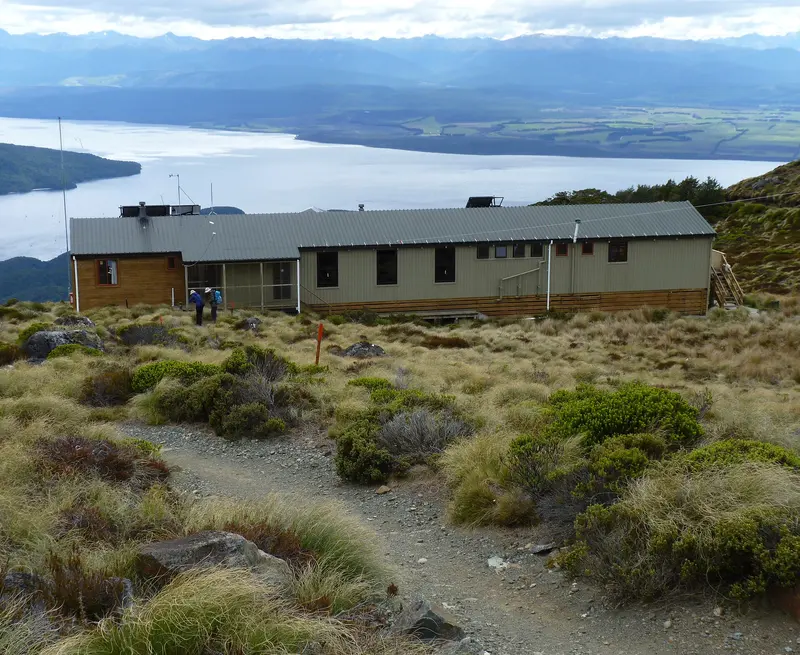
Photo: “Luxmore Hut, Kepler Track, New Zealand (27)” by Michal Klajban, CC BY-SA 4.0, via Wikimedia Commons
Trail at a glance
- Type
- Great Walk
- Region
- Fiordland
- Distance
- 60 km loop
- Time
- 3–4 days
- Grade
- Intermediate (in season)
- Bookings
- Required 27 Oct – 30 Apr
- Managed by
- Department of Conservation
Overview
The Kepler Track is a 60 km loop that starts and finishes near Te Anau, so it needs no complicated transport. It runs from the beech-forested shores of Lake Te Anau, the largest body of fresh water in Australasia, up onto exposed tussock ridges with panoramic views. Then it drops through the Iris Burn valley to Lake Manapouri. Most walkers take 4 days and 3 nights.
Seasons
- Great Walks season (27 October 2026 – 30 April 2027): The best time to go. Bookings are required for all huts and campsites, there are more facilities, and DOC manages hazards. Rated an intermediate tramping track.
- Outside the season (May – late October): Cold, icy and snowy, with frequent avalanches across 9 avalanche paths. There's no gas, the toilets are pit toilets and there are no rangers. Only attempt it if you're fit, experienced and carrying an ice axe, crampons and avalanche gear. Only Luxmore Hut needs booking then.
Track sections
| Section | Time | Distance |
|---|---|---|
| Kepler Track car park → Brod Bay | 1 hr 30 min | 5.6 km |
| Brod Bay → Luxmore Hut | 3.5–4.5 hr | 8.2 km |
| Luxmore Hut → Iris Burn Hut | 5–6 hr | 14.6 km |
| Iris Burn Hut → Moturau Hut | 5–6 hr | 16.2 km |
| Moturau Hut → Rainbow Reach | 1.5–2 hr | 6 km |
| Rainbow Reach → Kepler Track car park | 2.5–3.5 hr | 9.5 km |
Side trips: Luxmore Cave (20 min return from the hut) and Mt Luxmore summit (1,472 m, the highest point on the track, 30 min return).
Fill your water bottles at Luxmore Hut. There's no reliable water on the alpine section until Iris Burn.
Huts and campsites
There are three huts (Luxmore with 54 bunks, Iris Burn with 50 and Moturau with 40) and two campsites (Brod Bay and Iris Burn). Each has 15 tent sites. Huts have heating, lighting, cooking facilities and flush toilets in season. Tap water isn't treated, so boil it first. Camping in the Forest Burn or Hanging Valley shelters isn't allowed.
Day walks on the Kepler
You can sample the Kepler without booking:
- Kepler Track car park to Dock Bay and Brod Bay
- Car park to Rainbow Reach
- Rainbow Reach to Shallow Bay or Moturau Hut
- Car park to Luxmore Hut, a big day with a 1,000 m+ climb
Getting there
- Kepler Track car park: 5 km from Te Anau, or a 50-minute walk along the lakefront from the Fiordland National Park Visitor Centre
- Rainbow Reach car park: 12 km from Te Anau
- Shuttles run daily in season, and a scheduled boat goes to Brod Bay.
Hazards and tips
- Fiordland gets up to 9,000 mm of rain a year, and snow can fall in any month. Avalanche risk can last into December, and DOC may close the alpine section.
- Kea on the tops love tents and gear, so keep yours secure.
- Didymo is present in Lakes Te Anau and Manapouri and the Waiau River. Check, clean and dry your gear.
- The track isn't recommended for children under 10.
- The Kepler Challenge race takes over the track on the first Saturday in December.
Good to know
No dogs. Bookings for the 2026/27 season are open on DOC's website.
Route map
The line shows the Kepler Track as mapped in OpenStreetMap. It measures about 61.7 km, against an official distance of 60 km loop. Use it to see where the route goes. It isn't for navigation, so carry the official map and check track status with Department of Conservation (opens in a new tab) before you set out.
Location data: OpenStreetMap contributors (ODbL 1.0).
Check before you go
Closures, slips, snow and booking changes happen often. Department of Conservation posts current alerts and bookings for the Kepler Track on its official page.
Current alerts and bookings