Clutha Gold Trail: Roxburgh to Lake Waihola Great Ride Guide
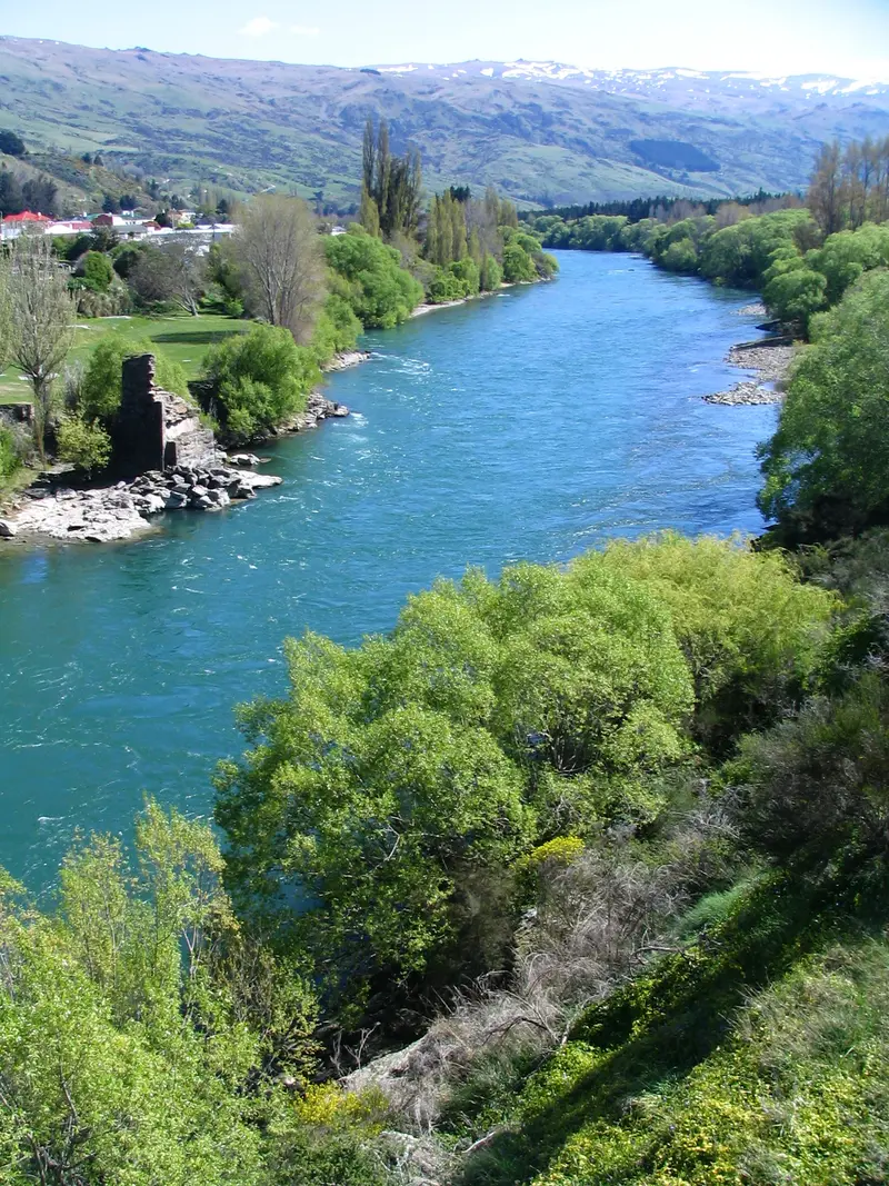
Photo: “Clutha River, Roxburgh, New Zealand” by Benchill, CC BY-SA 3.0, via Wikimedia Commons
Trail at a glance
- Type
- Great Ride
- Region
- Otago
- Distance
- 135 km
- Time
- 2–4 days
- Grade
- Grade 1–2 (easy)
- Bookings
- Not required
- Managed by
- Ngā Haerenga NZ Cycle Trail
Overview
The Clutha Gold Trail follows the Clutha Mata-au River from Roxburgh Dam through the Teviot Valley to Lawrence, Otago's first gold-rush town. A 62 km extension then continues to Lake Waihola, New Zealand's most inland tidal lake. In total it's 135 km, usually ridden over 2–4 days, or in shorter sections.
It's Grade 1–2, one of the easiest Great Rides, with a smooth, wide surface that's almost entirely flat. That makes it ideal for younger, older and less experienced riders. It connects upstream with the Roxburgh Gorge Trail and the Otago Central Rail Trail.
Highlights
- Ever-changing riverside scenery under the Old Man and Benger ranges
- Roxburgh Dam, New Zealand's biggest gravity-fed dam
- Swimming at Pinders Pond Reserve, the safe place to swim on the otherwise treacherous Clutha
- Horseshoe Bend Bridge (1913) and the Lonely Graves
- Three historic rail tunnels, including the 440 m Big Hill Tunnel (bring a torch)
- Roxburgh stone fruit, and Jimmy's Pies
- Lawrence's gold-rush history and Gabriel's Gully
- A 1.6 km boardwalk through the Lake Waihola wetlands
Trail sections
| Section | Distance | Time |
|---|---|---|
| Commissioners Flat (Roxburgh Dam) → Roxburgh | 9 km | 1 hr |
| Roxburgh → Millers Flat | 20 km | 2 hr |
| Millers Flat → Beaumont | 25 km | 1 hr |
| Beaumont → Lawrence | 19 km | 2–3 hr |
| Lawrence → Waitahuna | 14 km | 1–2 hr |
| Waitahuna → Milton | 31 km | 3 hr |
| Milton → Waihola | 17 km | 2 hr |
All sections are Grade 2 (easy). There are no services between Waitahuna and Milton, and that section shares some public gravel roads.
Day rides
| Ride | Distance | Time |
|---|---|---|
| Roxburgh → Roxburgh Dam (loop) | 20 km | 2 hr |
| Roxburgh → Millers Flat (return) | 42 km | 4–5 hr |
| Roxburgh Dam → Beaumont | 51 km | 4–6 hr |
| Lawrence → Mt Stuart Reserve (via two tunnels) | 30 km | 3 hr one way |
| Waihola → Milton | 17 km | 2 hr one way |
Need to know
- Bike: Almost any bike will do: hybrid, mountain, gravel or e-bike.
- Trail Tag and Passport: Support the trail by buying a Trail Tag ($25 per person or $50 per family for 12 months, or $10 for a day). The Trail Passport ($15) lets you collect pencil rubbings at brass plaques along the way. Buy both from local i-SITEs and bike companies.
- Weather: Hot, dry summers and freezing winters. Bring sun protection in summer and layers and gloves in winter.
- Mobile coverage: Good, apart from patches in the river narrows.
- Dogs and horses: Not allowed.
Getting there and where to stay
- Alexandra is half an hour from the trail start. Queenstown Airport is just over an hour from Alexandra, and Dunedin about 2.5 hours.
- Roxburgh and Lawrence are the main bases. InterCity serves the area, and local shuttles offer luggage transfers.
- Book ahead for January to April, and expect some businesses to wind down in winter.
Route map
The line shows the Clutha Gold Trail as mapped in OpenStreetMap. It measures about 135.9 km, against an official distance of 135 km. Use it to see where the route goes. It isn't for navigation, so carry the official map and check track status with Ngā Haerenga NZ Cycle Trail (opens in a new tab) before you set out.
Location data: OpenStreetMap contributors (ODbL 1.0).
Check before you go
Closures, slips, snow and booking changes happen often. Ngā Haerenga NZ Cycle Trail posts current alerts and bookings for the Clutha Gold Trail on its official page.
Current alerts and bookings