Blue Pools Track: Makarora's Famous Short Walk on the Haast Pass
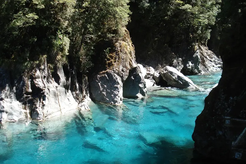
Photo: “Blue Pools” by AwOiSoAk KaOsIoWa, CC BY-SA 3.0, via Wikimedia Commons
Trail at a glance
- Type
- Day walk
- Region
- Otago
- Distance
- 3.2 km return
- Time
- 1 hr 30 min return
- Grade
- Easy short walk
- Bookings
- Not required
- Managed by
- Department of Conservation
Overview
The Blue Pools are one of the most popular stops on the Haast Highway (SH6) between Wānaka and Haast. An easy 1 hr 30 min return walk (3.2 km) through native silver beech (tāwhai) forest leads to swing bridges above crystal-clear, snow-fed river pools in Mount Aspiring National Park.
The pools are vivid blue only when it hasn't rained recently. After heavy rain they turn brown and muddy, so time your visit for a dry, sunny spell.
The walk
- Follow the signposted track from Blue Pools car park through beech forest for about 30 minutes to the swing bridge over the Makarora River.
- Turn left. Two minutes later you'll reach the second swing bridge, above the Blue Pools. Cross it for views of the pools and the river gorge.
- Return the same way. Beyond the bridge, the track becomes the Young River Link Track.
Grade: Easy short walk on a gravel path, with rocky sections and two swing bridges.
Getting there
The car park is well signposted on SH6, about halfway between Wānaka and Haast, 10 km past Makarora when you're driving from Wānaka.
| From | Drive time |
|---|---|
| Makarora | 10 min |
| Wānaka | 1 hr 10 min |
| Haast | 1 hr 10 min |
Parking is free for cars and campervans, with two mobility spaces. It gets very busy from November to April.
Safety and rules
- No jumping off the swing bridges. Rivers are unpredictable and hide dangers.
- No soap or washing in the pools. Don't build rock stacks, as cairns disturb the ecosystem.
- No rubbish bins, so take your rubbish with you. No dogs and no drones.
Facilities
There are toilets, including an accessible one, at the car park. There's no drinking water. Cameron Flat Campsite is across the road. Makarora has limited food and fuel.
Nature
Listen for bellbirds, grey warblers, riflemen and the rare yellowhead (mohua). Red native mistletoe flowers between October and January. The sandflies are fierce, so bring repellent.
Nearby
Thunder Creek Falls (28 m) and Roaring Billy Falls are both short walks further along the Haast Highway.
Route map
The line shows the Blue Pools Track as mapped in OpenStreetMap. It measures about 1.6 km, against an official distance of 3.2 km return. Use it to see where the route goes. It isn't for navigation, so carry the official map and check track status with Department of Conservation (opens in a new tab) before you set out.
Location data: OpenStreetMap contributors (ODbL 1.0).
Check before you go
Closures, slips, snow and booking changes happen often. Department of Conservation posts current alerts and bookings for the Blue Pools Track on its official page.
Current alerts and bookings