Avalanche Peak: Arthur's Pass Summit Route Guide
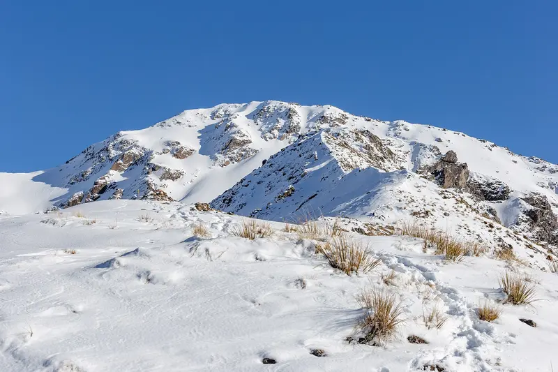
Photo: “Avalanche Peak, Arthur's Pass National Park, New Zealand” by Michal Klajban, CC BY-SA 4.0, via Wikimedia Commons
Trail at a glance
- Type
- Day walk
- Region
- Canterbury
- Distance
- 2.5 km one way
- Time
- 3–4 hr to summit
- Grade
- Advanced / expert route
- Bookings
- Not required
- Managed by
- Department of Conservation
Overview
Avalanche Peak (1,833 m) is the only peak in Arthur's Pass National Park marked by a poled route to the summit. It's brutally steep: 1,100 m of vertical climb over just 2.5 km. On a fine day the reward is a grand panorama of the Southern Alps / Kā Tiritiri o te Moana, including Mt Rolleston (Kaimatau) and the Crow Glacier.
People have died on this route. Above the bushline it's an exposed, rocky route with sheer drops. Don't attempt it in poor visibility or high winds, and turn back if you've found the track hard by the time you reach the bushline.
Two routes up
Both start from SH73 in Arthur's Pass village, about 700 m apart. Above the bushline they're routes marked with cairns and poles: yellow for the Avalanche Peak Route and orange for Scotts Route.
Round trip (recommended direction):
| Section | Time |
|---|---|
| Avalanche Peak Track: visitor centre → bushline (1,200 m) | 1 hr 30 min |
| Avalanche Peak Route: bushline → summit (yellow poles) | 1.5–2 hr |
| Scotts Route: summit → bushline (orange poles) | 1 hr 30 min |
| Scotts Track: bushline → SH73 / Punchbowl car park | 1–1.5 hr |
Up and back the same way: Use Scotts Track and Route, which is less steep. It starts 30 m from the Devils Punchbowl car park.
Key safety points
- The last 10 minutes to the summit follow a razor-edge ridge with sheer bluffs either side. If it's windy or icy, turn back.
- On the way down, follow Scotts Route toward Mt Cassidy, not toward Mt Rolleston. Don't try to cross between the two routes, because a hidden canyon blocks the way.
- If you're lost, don't head into the bush off the tracks, where there are impassable bluffs. Stay put until daylight. There's cellphone coverage in most places, so call 111 if you need to.
- Avalanches usually occur from May to November. In winter you'll need an ice axe, crampons and alpine experience.
Planning
- Grade: Advanced tramping track / expert route
- Best season: Summer and autumn
- Map: NZTopo50 Otira BV20
- Check track conditions and the avalanche advisory at the Arthur's Pass Visitor Centre before you go, and tell someone your plans.
- Don't walk along the highway between the two track ends.
Good to know
No dogs. Weather changes fast at Arthur's Pass, so carry warm layers and a waterproof even on a fine morning.
Check before you go
Closures, slips, snow and booking changes happen often. Department of Conservation posts current alerts and bookings for the Avalanche Peak on its official page.
Current alerts and bookings