Alps 2 Ocean Cycle Trail: Aoraki / Mt Cook to Oamaru Guide
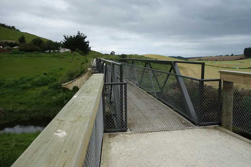
Photo: “Bridge near Enfield A2O 388” by Schwede66, CC BY-SA 4.0, via Wikimedia Commons
Trail at a glance
- Type
- Great Ride
- Region
- Canterbury & Otago
- Distance
- About 320 km
- Time
- 5–7 days
- Grade
- Grade 2–3 (easy–intermediate)
- Bookings
- Book helicopter hop and services ahead
- Managed by
- Ngā Haerenga NZ Cycle Trail
Overview
The Alps 2 Ocean Cycle Trail (A2O) runs from New Zealand's highest mountain, Aoraki / Mt Cook (3,754 m), to the Pacific Ocean at Oamaru. On the way you pass braided rivers, glacier-carved valleys, the turquoise hydro lakes of the Mackenzie and Waitaki, golden tussock, and the strange limestone formations of Elephant Rocks.
It's divided into nine sections, and most riders take 5–7 days for the full trail. Measured from Aoraki / Mt Cook, the main-route sections add up to roughly 320 km. It's graded 2–3 (easy to intermediate), so it suits reasonably fit riders, with plenty of shorter options for beginners.
Highlights
- Aoraki / Mt Cook, and the turquoise lakes and golden tussock of the Mackenzie Country
- Hydro dams and power stations, including Benmore Dam, New Zealand's largest earth dam
- Omarama's outdoor hot tubs and the dark night skies around Tekapo
- Waitaki wine country, craft breweries and the Takiroa Māori rock art site
- Elephant Rocks, and Oamaru's Victorian precinct and penguins
Trail sections
| Section | Distance | Grade | Time |
|---|---|---|---|
| Aoraki / Mt Cook → Braemar Road | 35 km | 2 | 3.5–4.5 hr |
| or Lake Tekapo → Twizel (alternative start) | 54 km | 2 | 4–5 hr |
| Braemar Road → Twizel | 42 km | 2 | 4–5 hr |
| Twizel → Lake Ohau Lodge | 38 km | 2 | 3–4 hr |
| Lake Ohau Lodge → Omarama | 45 km | 3 | 4–6 hr |
| Omarama → Otematata | 35 km | 2–3 | 3–4 hr |
| Otematata → Kurow | 44 km | 2–3 | 3.5–4 hr |
| Kurow → Duntroon | 28 km | 3 | 2–3 hr |
| Duntroon → Oamaru | 54 km | 3 | 5–6 hr |
The Tasman River helicopter hop: The Aoraki start includes a short, pre-booked helicopter transfer across the Tasman River, which depends on the weather. To skip it, start at Lake Tekapo, Tekapo B Power Station or Jollie car park.
The big climb: Lake Ohau to Omarama includes the trail's toughest climb, 300 m over 5 km to Tarnbrae High Point at 900 m, with an optional detour to the Clay Cliffs.
Watch out for: The Ahuriri arm section to Benmore Dam is narrow with steep drop-offs, so take extra care in wind. Ohau Weir can't be crossed in flood.
Day rides
| Ride | Distance | Grade |
|---|---|---|
| Aoraki / Mt Cook → Twizel (with helicopter hop) | 77 km | 2 |
| Lake Tekapo → Twizel | 54 km | 2 |
| Twizel → Lake Ohau | 38 km | 2 |
| Lake Ohau → Omarama | 45 km | 3 |
Need to know
- Surface: Canal paths, quiet country roads with stock and vehicles, old railway line and gravel bike track, with significant hills and steep drop-offs in places.
- Bike: A mountain bike is best, but hybrids with knobbly tyres will cope. E-bikes are allowed. Carry a tool kit.
- Weather: Highly changeable near the Alps. Pack warm and wet-weather gear in any season. Summer has little shade. Winter snow can close sections.
- Food and water: Tekapo, Twizel, Omarama and Oamaru are well served, but there are long stretches with no food or water, and small-town cafés may be closed out of season.
- Mobile coverage: Patchy in places.
- Dogs: Not allowed, except on public roads and the old railway line between Weston and the Waireka Saleyards. No horses.
Getting there and logistics
- Christchurch, Dunedin and Queenstown airports are 2–4 hours' drive away. InterCity buses serve Tekapo, Mt Cook Village, Twizel, Omarama and Oamaru.
- Twizel and Oamaru are the main hubs for bike hire, shuttles and luggage transfers.
- Book all services and accommodation early for December to April. Some providers close in winter.
Check before you go
Closures, slips, snow and booking changes happen often. Ngā Haerenga NZ Cycle Trail posts current alerts and bookings for the Alps 2 Ocean Cycle Trail on its official page.
Current alerts and bookings