Abel Tasman Coast Track: Great Walk Guide, Huts, Fees & Tides
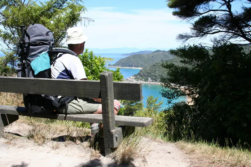
Photo: “Viewpoint - Abel Tasman Coast Track” by Department of Conservation, CC BY 2.0, via Wikimedia Commons
Trail at a glance
- Type
- Great Walk
- Region
- Nelson Tasman
- Distance
- 60 km one way
- Time
- 3–5 days
- Grade
- Intermediate tramping track
- Bookings
- Huts and campsites must be booked year-round
- Managed by
- Department of Conservation
Overview
The Abel Tasman Coast Track is one of the most accessible of New Zealand's Great Walks. It runs 60 km one way along the golden-sand coast of Abel Tasman National Park, near Nelson and Motueka. The route mixes lush coastal bush, granite headlands and bays of clear turquoise water. The climate is mild enough to walk it year-round.
Unlike alpine Great Walks, you don't have to do the whole thing. Water taxis stop at the main beaches, so you can walk a single section, combine walking and sea kayaking, or stay 3–5 nights in huts and campsites.
Highlights
- Cleopatra's Pool: A natural rock pool with a moss-lined waterslide, off the all-tide track at Torrent Bay
- Falls River swingbridge: A 47 m suspension bridge
- Tonga Island Marine Reserve: Crystal-clear water, with fur seals (kekeno) often seen nearby
- Onetahuti Bay: One of the longest beaches in the park
- Whariwharangi Hut: A historic former homestead built around 1896
Track sections
| Section | Time | Distance | Notes |
|---|---|---|---|
| Marahau → Anchorage | 4 hr | 12.4 km | Beech forest and big kānuka trees |
| Anchorage → Bark Bay | 3–4 hr | 8.4–11.5 km | Low-tide shortcut across Torrent Bay |
| Bark Bay → Awaroa | 4 hr 30 min | 13.5 km | Over Tonga Saddle |
| Awaroa → Tōtaranui | 2 hr 20 min | 7.1 km | Tidal crossing of Awaroa Inlet |
| Tōtaranui → Whariwharangi Bay | 3 hr 15 min | 9.8 km | |
| Whariwharangi Bay → Wainui | 2 hr | 5.7 km | Northern end of the track |
To return to Tōtaranui for a water taxi, take the steeper Gibbs Hill Track from Whariwharangi (3 hr, 9 km).
Tides: plan around them
- Awaroa Inlet is the one compulsory tidal crossing. Cross it in daylight only, within 1 hr 30 min before to 2 hr after low tide. Allow 25 minutes to cross, as there's no track around it.
- Torrent Bay estuary can be crossed within 2 hours either side of low tide, or you can take the all-tide track instead.
- Check DOC's low-tide timetables before you book, so your plan fits the tides.
Huts, campsites and 2026/27 fees
There are 4 huts and 18 campsites, and they must be booked in advance all year. Walkers without a booking may be charged a penalty or turned away. Hammocks aren't allowed in campsites.
| Per person, per night | Peak (1 Oct–30 Apr) NZ / international | Winter (1 Jul–31 Aug) |
|---|---|---|
| Hut, adult | $55 / $84 | $33 |
| Hut, child | $28 / $42 | $17 |
| Campsite, adult | $21 / $31 | $21 |
| Campsite, child | $10 / $15 | $10 |
Under-5s stay free, and the NZ rate requires proof of eligibility. There's no fee for day walks or to enter the national park. From October to April you can book each hut or campsite for a maximum of two nights.
The huts have heating but no cooking gas or lighting, so bring a stove, fuel and candles. Water at the huts and campsites isn't treated, so boil it before drinking.
Getting there
- Marahau (southern entrance): 67 km from Nelson on a sealed road
- Kaiteriteri: 61 km from Nelson, for water taxis and kayaks
- Tōtaranui: 160 km from Nelson via Tākaka (last 12 km unsealed)
- Wainui (northern entrance): 21 km from Tākaka
Most people walk one way and take a water taxi the other way. Taxis run year-round between Marahau or Kaiteriteri and Tōtaranui and must be booked ahead. They don't go north of Tōtaranui. There's strictly no freedom camping.
Kayaking
Guided trips are recommended if you haven't kayaked before. Independent rentals need at least two people and previous sea-kayaking experience. Kayaking isn't recommended north of Onetahuti Bay because that coast is exposed. Book campsites within your paddling range, and plan for headwinds.
When to go
The track is busiest from October to April. Winter is quiet, with calmer water, fewer insects and cooler, shorter days. Strong westerlies are common from late spring through summer. There are wasps and sandflies, so pack insect repellent, plus antihistamines if you're allergic to stings.
Good to know
- No dogs. No drones without a permit.
- Mountain biking is allowed only on the Wainui–Gibbs Hill–Tōtaranui section, from 1 May to 30 September.
- In a long or strong earthquake, move to higher ground immediately, because of the tsunami risk.
Route map
The line shows the Abel Tasman Coast Track as mapped in OpenStreetMap. It measures about 67.6 km, against an official distance of 60 km one way. Use it to see where the route goes. It isn't for navigation, so carry the official map and check track status with Department of Conservation (opens in a new tab) before you set out.
Location data: OpenStreetMap contributors (ODbL 1.0).
Check before you go
Closures, slips, snow and booking changes happen often. Department of Conservation posts current alerts and bookings for the Abel Tasman Coast Track on its official page.
Current alerts and bookings