Maungatauhoro / Wenderholm Regional Park: Auckland's First Regional Park
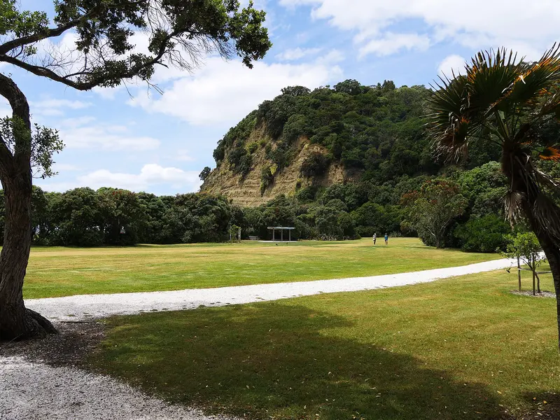
Photo: “Wenderholm Regional Park (with Cliffs)” by Ulrich Lange, Bochum, Germany, CC BY 3.0, via Wikimedia Commons
Park at a glance
- Region
- Auckland
- Location
- Pūhoi River mouth, Waiwera
- Managed by
- Auckland Council
- Dogs
- Dogs in some areas
- Camping
- Yes, see Camping section
Overview
Maungatauhoro / Wenderholm Regional Park sits at the mouth of the Pūhoi River, surrounded by forested headlands, just north of Waiwera. It was Auckland's first regional park, and Auckland Council still calls it "perhaps the most beautiful".
The park has about 900 metres of family-friendly beach next to big grassy picnic areas shaded by pōhutukawa. It also contains one of Auckland's best examples of mainland coastal forest. Historic Couldrey House is a homestead with Victorian and Edwardian furnishings and family stories, and opens to visitors (see couldreyhouse.org.nz for hours).
Getting there and opening hours
- Address: 37 Schischka Road, Waiwera
- Vehicle gate: 6am–9pm during daylight saving and 6am–7pm the rest of the year
- Parking: 290 spaces in the main car park, plus up to 400 overflow, 7 coach parks and 10 boat-trailer parks
Closures and notices
Closures change often, so check the official park page for the current status before you go.
- Perimeter Path: The section from the top of Maungatauhoro to Kokoru Bay is closed over winter to protect cultural sites and the track surface. It's expected to reopen around 30 October 2026, depending on ground conditions. Use the Pūhoi Track (blue markers) instead.
- Boat ramp pontoon: Closed because the stone jetty that reaches it is damaged. Repairs are expected to be finished by the end of 2026.
Walks and tracks
| Track | Time | Distance | Notes |
|---|---|---|---|
| Couldrey House Lookout Walk | 15 min | 600 m | |
| Te Akeake Walk | 30 min | 1–2 km | Prams OK |
| Maungatauhoro Te Hikoi | 90 min | 2 km | Through coastal forest |
| Perimeter Path | 90–150 min | 4–4.6 km | Part closed in winter |
The picnic areas, foreshore and park roads are all pram-friendly.
Things to do
Swimming and picnics
The 900 m sandy beach is relatively safe for swimming. Stay away from the Pūhoi River mouth, where deep water and strong tidal currents are a real danger. There are three free electric BBQs, and you can bring your own gas BBQ.
Kayaking the Pūhoi estuary
Paddle around the Pūhoi estuary or up the river. Launch from the boat ramp area or the often-calm beach, and watch the tide so you don't get stranded on the mudflats near low tide.
Couldrey House
This historic homestead is signposted from the southern end of the main car park and holds period furnishings and paintings. The short Couldrey House Lookout Walk starts nearby.
Land-based anglers try for kahawai and snapper at the river mouth (MPI rules apply). Birdwatchers can find kererū, tūī, ruru (morepork) and the rare dotterel. The boat ramp is all-weather, but avoid launching for three hours either side of low tide.
Dogs at Wenderholm
- Off-leash under control: The fenced grass area with the London plane trees, on the south-east (right-hand) side of Schischka Road between the gate and the service road
- On a leash: The Perimeter Track from that grass area to the Waiwera River and Kokoru Bay. Don't let your dog swim at Kokoru Bay because of strong currents.
- On a leash from 1 December to 30 June, prohibited from 1 July to 30 November: Tracks (including Vin's Track) and grass on the north-west side of Schischka Road
- Prohibited: Everything north of the service road, including Wenderholm Beach, the main grass areas, Te Akeake Walk, the Pūhoi estuary, roads, car parks and boat ramps (including in vehicles). Also the Pūhoi Track, the Couldrey House and Hikoi tracks, the houses and the campground.
Camping and places to stay
You can book Schischka campground, Schischka House, Wenderholm Beach House, and overnight and CSC parking through Auckland Council.
Where is Maungatauhoro / Wenderholm Regional Park?
The pin marks: Centre of the park area (-36.5357, 174.7081). It isn't an entrance or car park, so check the council's park page for access points before you go. Plan a route on OpenStreetMap (opens in a new tab).
Location data: Auckland Council Park Extents (CC BY 4.0); OpenStreetMap contributors (ODbL 1.0).
Check before you go
Track closures, gate times, fire bans and storm damage change often. Auckland Council posts current alerts for Maungatauhoro / Wenderholm Regional Park on its official park page.
Current park alerts