Waitākere Ranges Regional Park: Piha, Karekare, Kauri & Arataki
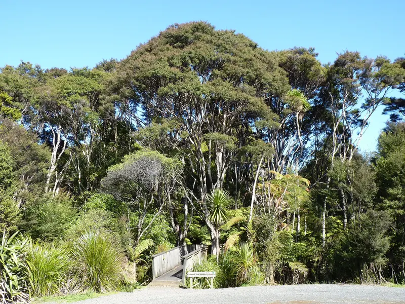
Photo: “Waitakere Ranges Regional Park, New Zealand” by Michal Klajban, CC BY-SA 4.0, via Wikimedia Commons
Park at a glance
- Region
- Auckland
- Location
- West Auckland
- Managed by
- Auckland Council
- Dogs
- Dogs in some areas
- Camping
- Yes, see Camping section
Overview
Waitākere Ranges Regional Park is the great forest on Auckland's western doorstep. It covers about 16,000 hectares of native rainforest: steep, bush-clad hill country with spectacular gorges, bluffs, waterfalls and water-supply dams. Along its western edge runs a rugged coastline of black-sand surf beaches, including Piha, Karekare and Te Henga (Bethells Beach).
Te Kawerau ā Maki are mana whenua of the "Great Forest of Tiriwā", as the ranges are known. The wider area is protected as the Waitākere Ranges Heritage Area.
Kauri dieback: check before you walk
Large sections of the track network are closed to stop the spread of kauri dieback. Use Auckland Council's open and closed tracks map before you go, stay on open tracks, and clean your footwear and gear at every hygiene station.
Start at Arataki
Arataki Visitor Centre
Arataki, at 300 Scenic Drive, is the gateway to the Waitākere Ranges and the wider regional park network. An 11 m carved kauri pou depicting Te Kawerau ā Maki ancestors greets you on arrival; it's one of the largest of its kind in New Zealand. Inside you'll find track information, exhibitions and nature activities, and the decks look out over the forest, the Lower Nihotupu dam and the Manukau Harbour. It's open 9am–5pm every day except Christmas Day and Boxing Day, has free WiFi, and offers a CSC overnight parking area. Dogs on a leash can use the grounds but not the building.
Areas of the park
Piha
Piha is one of Auckland's most famous black-sand beaches, with the landmark Lion Rock in the middle. Surfing is best at the northern and southern ends. The surf is dangerous: swim only between the red and yellow flags while lifeguards are on duty. Popular walks include the Kitekite Track (2.5 hr, 4 km), Tasman Lookout Track and Lion Rock Track.
Karekare
Karekare is a wild black-sand surf beach and a small coastal settlement with limited parking (54 spaces plus overflow). Nearby are Karekare Falls and the Mercer Bay Loop (about 1 hr). Beach patrols only run at certain times of year, so take extra care. You can camp at McCreadies Paddock and Tunnel Point.
Te Henga (Bethells Beach) and Lake Wainamu
Te Henga is a wild black-sand beach with good surf at Bethells and O'Neill Bay. Behind the dunes, Lake Wainamu is a popular freshwater alternative to the rough surf. The Te Henga Walkway (4 hr, 8 km) follows the clifftops. There is no mobile coverage at Bethells Beach.
Te Piringa / Cascade Kauri
In the northern ranges, off Falls Road and Te Henga Road, Te Piringa protects some of the oldest and most precious kauri stands. The forest is tapu and protected by a rāhui, so please use the wāhi whakanoa (cleansing place) at the entrance. The lower Te Piringa Walk takes about 40 minutes return. The Montana Heritage Trail loop to Waitākere Dam takes about 4.5 hours. You can swim below the bridge on the lower walk. Dogs are prohibited.
Huia and Cornwallis
On the sheltered Manukau side, Huia has tidal beaches that are safer for swimming than the west coast, plus forest walks, campgrounds and lodges. Cornwallis has about 1.3 km of family-friendly beach, bookable picnic sites with free gas BBQs, and the 200 m restored Cornwallis wharf. It's the last of the Manukau Harbour's 16 ferry wharves and is wheelchair accessible.
Anawhata and Whatipū
Anawhata is a spectacular beach you can only reach on foot, so it's much quieter than its neighbours, and it isn't patrolled. Whatipū, at the southern tip, is a DOC scientific reserve of dunes and wetlands managed by Auckland Council, with caves, the Omanawanui Track and powerful surf. Whatipū Lodge and Pararaha Valley campground offer places to stay.
Swimming safety on the west coast
The west coast beaches have large waves and strong rip currents. Swim only between the flags while lifeguards are on duty, never swim alone or on an outgoing tide, and always wear a lifejacket when fishing from the rocks. Check Safeswim before you go.
Dogs in the Waitākere Ranges
Rules differ a lot between areas, so check the specific area page. In summary:
- Off-leash at times: Piha beach between Monkey Rock and Little Lion Rock Corner (sunrise to sunset), parts of Bethells Beach and Waitākere Bay (daytime, with seasonal limits), Cornwallis beach (sunrise to 9am), and Kakamatua beach and foreshore
- On a leash: Arataki grounds, Huia park areas, Karekare's main beach north of the island headland, and other signposted areas
- Prohibited: Te Piringa / Cascade Kauri, Whatipū, the Anawhata Beach Track, Lake Wainamu and the Te Henga Walkway, Lion and Monkey rocks, all campgrounds, and much of the track network
Camping and places to stay
There are bookable campgrounds at Huia (Karamatura Valley, Barn Paddock), Karekare (McCreadies Paddock, Tunnel Point), Anawhata (Craw), Cascade Kauri (Pae o te Rangi) and Whatipū (Pararaha Valley). You can also book baches and lodges, including Barr Cottage, Huia Lodge, Craw Homestead and Keddle House, plus several CSC parking areas.
Where is Waitākere Ranges Regional Park?
The pin marks: Centre of the park area (-36.9552, 174.5886). It isn't an entrance or car park, so check the council's park page for access points before you go. Plan a route on OpenStreetMap (opens in a new tab).
Location data: Auckland Council Park Extents (CC BY 4.0); OpenStreetMap contributors (ODbL 1.0).
Check before you go
Track closures, gate times, fire bans and storm damage change often. Auckland Council posts current alerts for Waitākere Ranges Regional Park on its official park page.
Current park alerts