Tūtira Regional Park: Lakeside Camping Between Napier and Wairoa
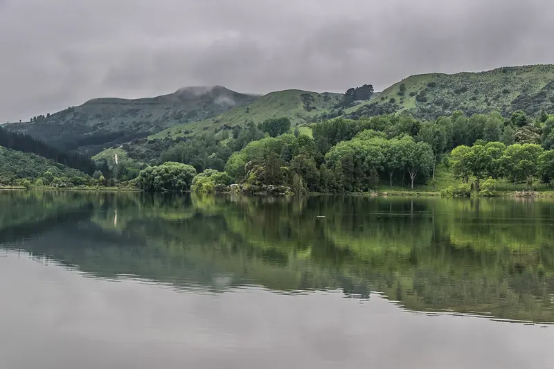
Photo: “Lake Tutira 03” by Krzysztof Golik, CC BY-SA 4.0, via Wikimedia Commons
Park at a glance
- Region
- Hawke's Bay
- Location
- Tūtira, north of Napier
- Managed by
- Hawke's Bay Regional Council
- Dogs
- No dogs
- Camping
- Yes, see Camping section
Overview
Tūtira Regional Park sits beneath steep, dramatic hills between Napier and Wairoa, beside twin lakes: Tūtira and Waikopirō. It's a lovely spot for a picnic, a walk, birdwatching or a night under canvas. It also works as a land-use demonstration area: many of its trees were planted by school students, community groups and council volunteers.
Across the lake is the historic Guthrie-Smith Trust homestead, education centre and arboretum of 20,000 trees. It's open free every Sunday from October to May.
Getting there
- Location: 3488 State Highway 2, Tūtira, 41 km north of Napier and 77 km south of Wairoa
- Access: Go through the gates and the DOC wildlife reserve, cross the causeway between the two lakes, and follow the track to the signposted park gate. Camping is to the right.
- It's on the Napier–Wairoa Heritage Trail.
The access road is narrow, with limited visibility at the entrance. The causeway can flood and become impassable in heavy rain.
Camping
Short-term camping is available in a flat, fenced, tree-lined paddock suitable for tents, campervans and caravans. These are remote campsites:
- Fee: $15 per vehicle per night. Pay online before you arrive, as mobile reception is limited, and keep your proof of payment.
- Facilities: Compost toilets (serviced weekly from November to February; bring your own toilet paper just in case) and non-potable water for handwashing only. There's no kitchen and no showers.
- Bring your own drinking water.
Lake safety
Don't swim in the lakes. They have periodic toxic algal blooms and duck itch. No motorised craft are allowed. Wash and check kayaks and boats for weed fragments before launching, because a hydrilla eradication programme is under way.
Rules
- No dogs, cats or other pets
- No mountain biking in the park
- Close the gates on walking tracks between paddocks, and take care around cattle with calves
- Keep clear of forestry operations and log piles
- Watch out for ongaonga (native stinging nettle), which can cause extreme pain
- Pack in, pack out
Explore nearby
Tūtira makes a handy base for the Maungaharuru district. Nearby are DOC's Lake Opouahi and kiwi crèche, Tangoio Falls and White Pine Bush, Boundary Stream Mainland Island and Shine Falls, plus Waipātiki Beach.
Emergency
Mobile coverage is sparse. In an emergency, call 111 and quote "Tūtira Regional Park, 3488 State Highway 2, Tūtira".
Where is Tūtira Regional Park?
The pin marks: Centre of the park area (-39.2213, 176.9102). It isn't an entrance or car park, so check the council's park page for access points before you go. Plan a route on OpenStreetMap (opens in a new tab).
Location data: OpenStreetMap contributors (ODbL 1.0).
Check before you go
Track closures, gate times, fire bans and storm damage change often. Hawke's Bay Regional Council posts current alerts for Tūtira Regional Park on its official park page.
Current park alerts