Tāpapakanga Regional Park: Firth of Thames Beach Camping
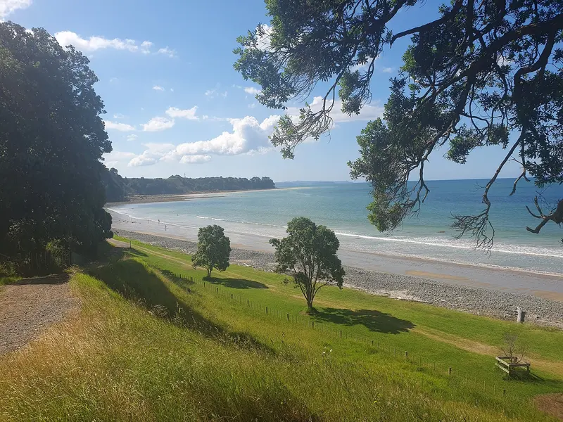
Photo: “20221227 162743 Tāpapakanga Regional Park” by Prosperosity, CC BY 4.0, via Wikimedia Commons
Park at a glance
- Region
- Auckland
- Location
- Ōrere Point, Firth of Thames
- Managed by
- Auckland Council
- Dogs
- Dogs in some areas
- Camping
- Yes, see Camping section
Overview
Tāpapakanga Regional Park is a coastal farm park on the western shore of the Firth of Thames, near Ōrere Point in south-east Auckland. It has a rich Māori and European history. The historic Ashby Homestead looks across the firth to the Coromandel Peninsula, and the Tāpapakanga Stream winds through the farmland to an accessible, pōhutukawa-edged beach.
Tāpapakanga has three campgrounds and a beach suitable for families.
Getting there and opening hours
- Address: 95 Deerys Road, Ōrere Point
- Vehicle gate: 6am–9pm during daylight saving and 6am–7pm the rest of the year
- Walk-in access: 24 hours
Walks and tracks
| Track | Time | Distance |
|---|---|---|
| Historic Loop Track | 30 min | 1.4–1.5 km |
| Coastal Loop Track | 45 min | 2 km |
| Farm Walk | 2 hr | 5.9 km |
| Coastal Walk | 2 hr | 7.4 km |
| Mountain Bike Track | 60 min (riding) | 6.9 km |
Things to do
Swimming and picnics
The beach is suitable for families. There are designated picnic sites behind the beach, and groups of 15 or more should book. Two gas BBQs are on the foreshore near the beach car park.
Birdwatching on the Seabird Coast
Look out for black and pied shags, oystercatchers, white-faced herons, kererū, tūī and kingfishers along the coast and stream.
You can fish off the beach. As anywhere on an exposed coast, wear a lifejacket when fishing from the rocks.
Dogs at Tāpapakanga
Tāpapakanga is one of the few Auckland regional parks with an off-leash beach:
- Off-leash under control (all year, including lambing): The beach near Ashby Homestead, from the western boundary to the stream by Ashby Cemetery
- On a leash: The open grass between the beach and car park, and the car park by Ashby Homestead
- On a leash from 1 December to 30 June, and prohibited from 1 July to 30 November: All other areas, including the Farm Walk, Historic Loop Track and Coastal Walk. During lambing, dogs are also banned from being in a vehicle there, but can reach the homestead car park by vehicle from Deerys Road.
- Prohibited at all times: Ashby Homestead, Tāpapakanga Bach, all three campgrounds and the CSC/overnight parking areas
Camping and places to stay
You can book the Beachfront, Seaview and Waikaha Stream campgrounds, Tāpapakanga Bach, and several CSC and overnight parking areas (including Kaparanui Stream and Tāpapakanga Stream).
Where is Tāpapakanga Regional Park?
The pin marks: Centre of the park area (-36.9795, 175.2566). It isn't an entrance or car park, so check the council's park page for access points before you go. Plan a route on OpenStreetMap (opens in a new tab).
Location data: Auckland Council Park Extents (CC BY 4.0); OpenStreetMap contributors (ODbL 1.0).
Check before you go
Track closures, gate times, fire bans and storm damage change often. Auckland Council posts current alerts for Tāpapakanga Regional Park on its official park page.
Current park alerts