Scandrett Regional Park: Baches, Beach & History on Mahurangi Peninsula
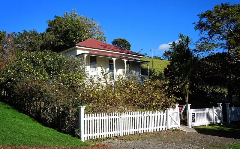
Photo: “Scandrett Regional Park” by possumgirl2, CC BY-SA 2.0, via Wikimedia Commons
Park at a glance
- Region
- Auckland
- Location
- Mahurangi Peninsula, near Snells Beach
- Managed by
- Auckland Council
- Dogs
- No dogs
- Camping
- No
Overview
Scandrett Regional Park sits on the north-eastern tip of the Mahurangi Peninsula, near Snells Beach and Martins Bay. It takes in Mullet Point and the rocky headlands that push out into Kawau Bay. You'll find a sheltered beach, regenerating coastal forest and a group of historic farm buildings. The Scandrett family owned and farmed the land from 1863.
Information panels around the homestead and farm buildings tell the family's story. Auckland Council has also published a video of Joan Scandrett talking about farming, raising a family and holidays at Scandretts Bay.
Getting there and opening hours
- Address: 114 Scandrett Road, Mahurangi East
- Vehicle gate: 6am–9pm during daylight saving and 6am–7pm the rest of the year. The gate is about 200 m past the cattle stop.
- Road: About 1.5 km of unsealed road, then sealed down to the main car park
- Parking: Around 40 spaces at Scandretts Bay, about 10 at the entrance and 10 on the hilltop in good conditions. Large vehicles should use the hilltop car park.
Walks and tracks
| Track | Time | Distance |
|---|---|---|
| Martins Bay Track | 7 min | 350 m |
| Scandretts Bay Loop | 40–45 min | 1–1.5 km |
| Scandrett to Martins Bay Path | 40 min | 1.5 km |
| Mullet Point Loop | 40–60 min | 1.6–2 km |
The beachfront is fine for prams. The tracks have steep sections, stiles and gates.
Things to do
Swimming and snorkelling at Scandretts Bay
The bay is calm and suitable for children, but it's very tidal. Swim at high tide, because at low tide you have to cross a wide stretch of mudflats. The shallow water is good for snorkelling. Experienced divers can reach a deep rock shelf at Mullet Point after a long walk over rocks.
Mullet Point pā and Kawau Bay views
The walks lead to a pā site at Mullet Point and to high viewpoints over the Hauraki Gulf, with Kawau Island clearly in view. They also pass the old farm precinct and former orchard.
Kayaking is pleasant inside the sheltered bay, and experienced paddlers can head out to Kawau Island. Launching is hard at low tide. The nearest boat ramp is at Martins Bay, about a 5-minute drive away.
No fishing at Scandrett
Scandrett is surrounded by the Kawau Bay high protection area, one of the Hauraki Gulf's new marine protections. You can't fish or take any seafood here. See DOC's website for boundary maps.
Dogs at Scandrett
Dogs are prohibited at all times in the park, campsites, farmland, beach and foreshore, including inside vehicles.
Places to stay
There's no tent campground. You can book three baches (Coldham, Graham and Moonlight), overnight car parking and a CSC parking area. Graham Bach has limited-mobility facilities.
Where is Scandrett Regional Park?
The pin marks: Centre of the park area (-36.4426, 174.7731). It isn't an entrance or car park, so check the council's park page for access points before you go. Plan a route on OpenStreetMap (opens in a new tab).
Location data: Auckland Council Park Extents (CC BY 4.0); OpenStreetMap contributors (ODbL 1.0).
Check before you go
Track closures, gate times, fire bans and storm damage change often. Auckland Council posts current alerts for Scandrett Regional Park on its official park page.
Current park alerts