Pākiri Regional Park: Walk-In Views of Little Barrier Island
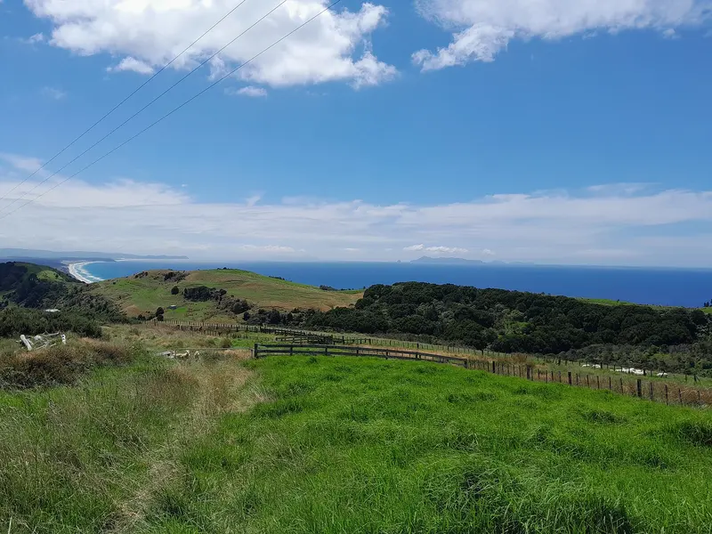
Photo: “Overlooking Pākiri Regional Park from it's south-western boundary” by MangoMan11, CC0, via Wikimedia Commons
Park at a glance
- Region
- Auckland
- Location
- Pākiri, north of Leigh
- Managed by
- Auckland Council
- Dogs
- No dogs
- Camping
- No
Overview
Pākiri Regional Park is one of Auckland's least developed regional parks. It's a small area of hillside farmland running down to coastal pōhutukawa forest above Pākiri Beach, north of Leigh. Its main draw is the uninterrupted view across the sea to Hauturu-o-Toi / Little Barrier Island.
The area is home to endangered birds and culturally significant sites. Walking is limited, and the park suits a quiet visit rather than a full day out.
Getting there
- Access point: 114 M Greenwood Road, Pākiri
- No public vehicle access into the park. Park on the grass verge at M Greenwood Road (space is limited) and walk in.
- The road is narrow and winding, with a 40 km/h speed limit. Drive carefully.
The park borders private land. Follow the property boundary signs, respect neighbours' privacy, and park considerately.
What to bring
There are no toilets and no drinking water at the park, so take what you need. The nearest public toilets are:
- 24 Hill Street, Leigh (about 6.9 km / 11 minutes' drive)
- 141 Goat Island Road, Leigh (about 7.8 km / 13 minutes' drive)
Things to do
Walk down to the coastal forest
Wander down the hillside through the park land to the pōhutukawa forest on the coast, with Little Barrier Island in view most of the way. Keep to the park land and don't disturb nesting birds or cultural sites.
Pākiri Regional Park is close to Goat Island Marine Reserve and the village of Leigh, so it's easy to combine with a day trip up the coast.
Dogs at Pākiri
Dogs are prohibited at all times throughout the park, on Pākiri Beach and its foreshore, and on the adjoining Department of Conservation land.
Good to know
- Overnight camping is not allowed.
- Drones are banned, because they threaten endangered birds and culturally significant sites.
- Check Safeswim for beach conditions.
Where is Pākiri Regional Park?
The pin marks: Centre of the park area (-36.2593, 174.7450). It isn't an entrance or car park, so check the council's park page for access points before you go. Plan a route on OpenStreetMap (opens in a new tab).
Location data: Auckland Council Park Extents (CC BY 4.0); OpenStreetMap contributors (ODbL 1.0).
Check before you go
Track closures, gate times, fire bans and storm damage change often. Auckland Council posts current alerts for Pākiri Regional Park on its official park page.
Current park alerts