Onekawa Te Mawhai Regional Park: Ōhiwa Harbour Headland Pā Walk
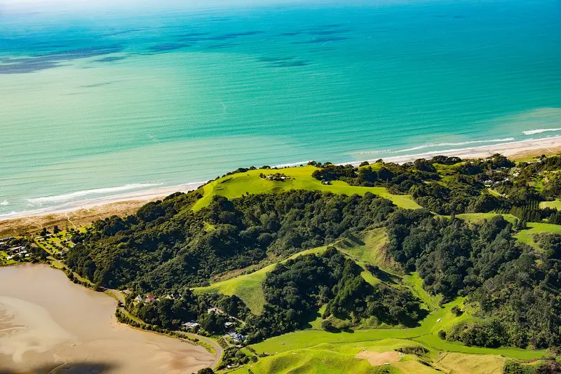
Photo: “Onekawa” by Dan Van Nistelrooy, CC BY 2.0, via Wikimedia Commons
Park at a glance
- Region
- Bay of Plenty
- Location
- Ōhiwa, near Ōpōtiki
- Managed by
- Bay of Plenty Regional Council
- Dogs
- Dogs on lead
- Camping
- No
Overview
Onekawa Te Mawhai Regional Park covers the spectacular headland between Ōhiwa Harbour and Bryans Beach, between Whakatāne and Ōpōtiki in the eastern Bay of Plenty. The Upokorehe hapū and Bay of Plenty Regional Council opened it together in 2010. It also takes in the dense coastal forest of the neighbouring Ōhiwa Domain.
This headland was once a populous stronghold with six pā, and many archaeological features are still clearly visible. On a clear day the views are huge: across Ōhiwa Harbour, west to Mauao (the Mount), east to Te Kaha and the Raukūmara Ranges, and south into Te Urewera.
Getting there
The park is signposted from SH2 at the Waiōtahe River bridge.
- From Ōpōtiki: Head west on SH2 toward Whakatāne and turn right into Ōhiwa Beach Road (15 km, about 10 minutes).
- From Whakatāne: Head east via Ōhope onto SH2 toward Ōpōtiki and turn left into Ōhiwa Beach Road (40 km, about 35 minutes).
- Parking: On Ōhiwa Beach Road, turn left into Ōhiwa Harbour Road toward the holiday park. The car park is on the right just before it. Alternatively, follow Ōhiwa Beach Road around the Waiōtahe estuary to the car park off Bryan Road, at the Bryans Beach end.
The walk
A 30-minute climb through old pūriri and pōhutukawa forest takes you to the summit of Onekawa Pā. Thanks to the council's regular pest control, plenty of tūī and kererū keep you company on the way.
Two tracks lead down to Bryans Beach. From there you can walk back along the beach to the entrance. The full loop takes about 1½ hours.
Rules
To protect the archaeological sites and the cattle and sheep that graze part of the park:
- Dogs must be on a lead
- No bikes or horses
- No camping and no fires
- Take all your rubbish with you
Facilities
There are no toilets in the park. The nearest public toilet is beside the car park at the Ōhiwa Spit. Check Bay of Plenty Regional Council's website for any track closures before you go.
Where is Onekawa Te Mawhai Regional Park?
The pin marks: Centre of the park area (-37.9910, 177.1673). It isn't an entrance or car park, so check the council's park page for access points before you go. Plan a route on OpenStreetMap (opens in a new tab).
Location data: OpenStreetMap contributors (ODbL 1.0).
Check before you go
Track closures, gate times, fire bans and storm damage change often. Bay of Plenty Regional Council posts current alerts for Onekawa Te Mawhai Regional Park on its official park page.
Current park alerts