Muriwai Regional Park: Gannet Colony, Black Sand Surf & Walks
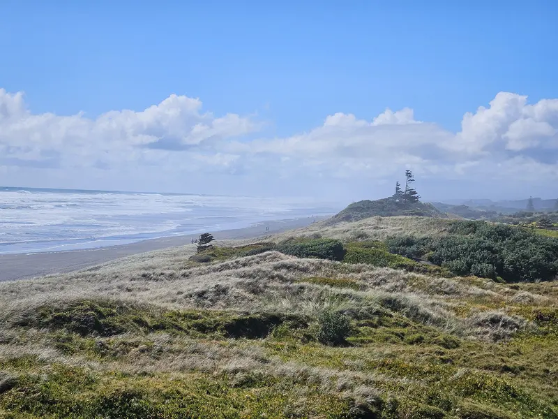
Photo: “Muriwai Regional Park sand dunes 20250104 163638” by Prosperosity, CC BY 4.0, via Wikimedia Commons
Park at a glance
- Region
- Auckland
- Location
- Muriwai, west Auckland
- Managed by
- Auckland Council
- Dogs
- Dogs in some areas
- Camping
- No
Overview
Muriwai Regional Park is on Auckland's wild west coast, where a rugged black-sand beach stretches about 60 km north. The headline attraction is at the southern end: on Otakamiro Point, takapu (Australasian gannets) breed in one of the few mainland gannet colonies in New Zealand. Lookouts above the point let you watch them up close.
Around the beach the park has bush walks and lookouts, BBQs and picnic areas, three tennis courts, a playground and a small skate park.
Getting there and opening hours
- Address: 458 Motutara Road, Muriwai
- Gate hours: 6am–9pm in summer and 6am–7.30pm in winter
- Parking: About 360 spaces, with more at the Village Green and Five Mile Strip
When to see the gannets
The gannet colony is at its busiest between October and February, when the birds are nesting and raising chicks. Auckland Council also runs a live YouTube stream of the colony and its nesting rock.
Walks and tracks
| Track | Time | Distance |
|---|---|---|
| Maukatia / Māori Bay Track | Under 15 min | 200 m |
| Muriwai Quarry Track | 15 min | 450 m |
| Maukatia Gannet Track / Gannet Refuge Walk | 25–30 min | 0.8–1.3 km |
| Muriwai Lookout Track | 30 min | 700 m |
| Edwin Mitchelson Track | 30 min | 1.1 km |
Some tracks are closed to protect kauri from kauri dieback. Check which tracks are open and clean your footwear before you go.
Things to do
Surfing at Muriwai and Māori Bay
Muriwai Beach and Maukatia / Māori Bay both have good surf. Māori Bay is more consistent but usually crowded. The surf here is dangerous, with large waves and strong rips. Only swim between the red and yellow flags while lifeguards are on duty, never swim alone or on an outgoing tide, and don't surf alone. There's an emergency phone at the surf tower.
Driving and riding on the beach
You need a beach driving permit to drive on Muriwai Beach. Your vehicle must have a current WOF and registration, and you can only drive between the low- and high-water lines. Horse riders can use a sand loop trail through the Five Mile Strip and ride north up the beach from the horse park. Watch for vehicles at weekends.
Fishing off the west coast rocks is dangerous. Always wear a lifejacket, and ask lifeguards or rangers about conditions. Lighting fires is prohibited.
Dogs at Muriwai
- Off-leash under control: Muriwai Beach north of the surf tower
- On a leash: Other grassed and picnic areas, the Muriwai Beach Loop Track and the Mitchelson Lookout Track
- Prohibited: The beach south of the surf tower; everything on the seaward side of Waitea Road, including the gannet colony, Otakamiro Point and Māori Bay; the playground, tennis courts and pump track; and the campground and golf club
Camping
The Muriwai Beach Campground isn't booked through the regional park system, so contact it directly.
Where is Muriwai Regional Park?
The pin marks: Centre of the park area (-36.7990, 174.4112). It isn't an entrance or car park, so check the council's park page for access points before you go. Plan a route on OpenStreetMap (opens in a new tab).
Location data: Auckland Council Park Extents (CC BY 4.0); OpenStreetMap contributors (ODbL 1.0).
Check before you go
Track closures, gate times, fire bans and storm damage change often. Auckland Council posts current alerts for Muriwai Regional Park on its official park page.
Current park alerts