Duder Regional Park: Coastal Farm Walks Near Clevedon
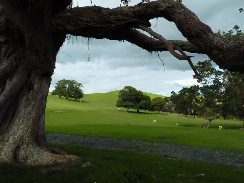
Photo: “Duder Regional Park, New Zealand (7)” by Michal Klajban, CC BY-SA 4.0, via Wikimedia Commons
Park at a glance
- Region
- Auckland
- Location
- Whakakaiwhara Peninsula, Clevedon
- Managed by
- Auckland Council
- Dogs
- No dogs
- Camping
- Yes, see Camping section
Overview
Duder Regional Park covers the Whakakaiwhara Peninsula, which juts into the Tāmaki Strait east of Clevedon. Pōhutukawa line its edges. The peninsula is mostly open, gently rolling farmland with few buildings. From the high ground you get 360-degree views over the Hunua Ranges, the Hauraki Gulf islands and the city, and with water on three sides it can feel like you're on your own island.
At the tip of the peninsula is the Whakakaiwhara pā site, one of the park's main walks. The council's history brochure covers the long Māori and European history of the area.
Getting there and opening hours
- Address: 933R North Road, Clevedon
- Vehicle gate: 6am–9pm during daylight saving and 6am–7pm the rest of the year
- Walk-in access: 24 hours
- Parking: 29 spaces on loose gravel, with no marked mobility parks
Walks and tracks
| Track | Time | Distance | Notes |
|---|---|---|---|
| Duder Coastal Walk | 30 min | 2 km | Best at low tide |
| Whakakaiwhara Pā Walk | 60 min | 2.4 km | Up to the pā site |
| Duck Bay Track | 60 min | 2.6 km | |
| Kōwhai Track | 60 min | 4 km | |
| Farm Loop | 80–120 min | 4.3 km | Best coastal views |
Parts of the park can be reached by wheelchair on the well-formed paths, and the picnic area next to the car park is flat and accessible. You can take a pram as far as the stockyards.
Things to do
Beaches at Duder
Duder has several good beaches, including Waipokaia / Duck Bay and Waiapu Bay / Sandy Bay, that are swimmable at all tides. The coast is popular for fishing and gathering shellfish, so check the MPI rules first.
Farm Loop and the pā site
For a short outing, walk up to the pā site, or do the Coastal Walk at low tide. If you've got more time, the Farm Loop crosses the farmland and has some of the best coastal views in Auckland.
Mountain bikers can ride a 4 km farm loop. A single-loop horse trail is open outside winter. It closes from 1 July to 30 September, and horses aren't allowed on the beaches or the shell bank. There's also a 24-marker orienteering course.
Dogs at Duder
Dogs are prohibited at all times everywhere in the park, including the beaches, foreshore, campground and baches.
Camping and places to stay
You can book Te Wharau (Malua Bay) campground, Te Kuiti Cottage, Te Whetuki House and a CSC overnight parking area through Auckland Council.
Good to know
Drones are not allowed. There is one toilet block with three toilets, with accessible toilets at the main car park.
Where is Duder Regional Park?
The pin marks: Centre of the park area (-36.9067, 175.0823). It isn't an entrance or car park, so check the council's park page for access points before you go. Plan a route on OpenStreetMap (opens in a new tab).
Location data: Auckland Council Park Extents (CC BY 4.0); OpenStreetMap contributors (ODbL 1.0).
Check before you go
Track closures, gate times, fire bans and storm damage change often. Auckland Council posts current alerts for Duder Regional Park on its official park page.
Current park alerts