Belmont Regional Park: Walks, Mountain Biking & Camping in the Hutt Hills
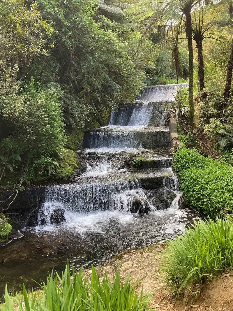
Photo: “Korokoro Dam, Belmont Regional Park, New Zealand” by Gertrude206, CC0, via Wikimedia Commons
Park at a glance
- Region
- Wellington
- Location
- Between Porirua and Lower Hutt
- Managed by
- Greater Wellington Regional Council
- Dogs
- Dogs in some areas
- Camping
- Yes, see Camping section
Overview
Belmont Regional Park is Greater Wellington's largest park and has the most entrances. It covers the hill country between Porirua and the Hutt Valley. The breathtaking views and bush-clad valleys make it a favourite for picnics, walking, running, mountain biking and horse riding.
The landscape holds the historic Korokoro Dam, Pareraho Pā, World War II ammunition stores, the original main coach road from Wellington, and remnants of ancient boulder fields. Climb to Belmont Trig (456 m) for sweeping views over Porirua Harbour and the Hutt Valley. As one ranger puts it, "It's like visiting the country just five minutes from the city."
Getting there and opening hours
- From Lower Hutt: Oakleigh Street (Maungaraki) or Cornish Street (Petone) for Korokoro Dam
- From Upper Hutt / Haywards: Dry Creek, via Hebden Crescent near the SH2/SH58 intersection, with camping
- From Porirua: Cannons Creek and Waihora Crescent, or Takapu Road for Transmission Gully viewpoints
- Other entrances: Stratton Street, Hill Road, Old Coach Road and Belmont Road
- Bus: Route 145 from Waterloo or Melling Station to Hill Road (stop 9358), Monday to Saturday
- Hours: Always open on foot. The Dry Creek automatic gate is open 5am–9pm from 1 October to 31 March and 6am–6pm from 1 April to 30 September. Parts of the farm may close during lambing.
Walks
| Track | Distance / time | Grade | Highlights |
|---|---|---|---|
| Viaduct View Walk | 500 m / 15 min | Easy | View of Te Ara o Toa, Transmission Gully's biggest bridge |
| Waterfall Route (Dry Creek) | 2.2 km / 45 min return | Easy | Scramble up to a small waterfall; wet feet guaranteed |
| Māra Roa Loop Walk | 2.5 km / 1 hr | Easy | Replanted bush; dogs on lead |
| Korokoro Dam Loop | 2.7 km / 1 hr | Intermediate | Nīkau and original forest to the dam |
| Korokoro Stream Track | 8 km / 3 hr return | Intermediate | Old pipeline route to the dam |
| Belmont Farm Loop | 8.4 km / 3 hr | Intermediate | WWII munitions stores; no dogs |
| Belmont Trig Loop | 10.8 km / 4 hr | Hard | Highest point in the park |
| Puke Ariki / Haywards–Korokoro Traverse | 22 km / 7–8 hr | Hard | The full length of the park |
Mountain biking
Belmont mountain bike area
Above Stratton Street and Hill Road there's a purpose-built trail network with a skills area and a gentle 3.6 km climbing trail called Four Degrees. Downhill runs range from Grade 3 (Bull Run, Electric Avenue, Wētā) to Grade 4 (Borderline) and Grade 5 (Off Camber Daze). The clay surfaces get very slippery when wet.
Big rides
Longer rides include the Dry Creek Loop (9 km), the Kilmister Loop past WWII bunkers (12 km), the Belmont Dress Circle (13.5 km, advanced) and the 22 km Haywards–Korokoro Traverse over Boulder Hill (442 m) to Petone. Catch the train back or ride the Hutt River Trail.
Horse riding needs an annual permit and a key bond. Riders usually start at Stratton Street or Dry Creek.
Dogs at Belmont
Dogs are welcome on a lead in the Korokoro, Stratton Street and Dry Creek valleys. Some Porirua-side tracks, such as Māra Roa and Waihora Loop, have signposted off-lead areas. Dogs aren't allowed on farmland. Dog bins are at the Cornish Street and Oakleigh Street entrances. Dogs are also allowed at the Dry Creek campground, kept under control.
Camping and places to stay
Dry Creek campground is open year-round on a first-come basis, with no bookings. It has treated drinking water, flushing toilets and an outdoor sink, but no powered sites and no dump station. Fees are $8 per adult, $4 per child (5–16) and free for under-5s, payable by PayWave or cash at the honesty box. Stays are limited to 7 nights a month. No fires are allowed anywhere in Belmont.
Boulder Field House is a restored three-bedroom park house just inside the Hill Road entrance, about 15 minutes from Lower Hutt.
Closures and notices
Check the official park page for the current status before you go.
Transmission Gully works: From Monday to Saturday, keep off the tracks near the motorway between the Takapu Road entrance and the bottom of Duck Creek Track. The lower Cannons Head Track and its underpass are also closed except on Sundays while NZTA restores the old construction sites.
Where is Belmont Regional Park?
The pin marks: Centre of the park area (-41.1668, 174.8957). It isn't an entrance or car park, so check the council's park page for access points before you go. Plan a route on OpenStreetMap (opens in a new tab).
Location data: OpenStreetMap contributors (ODbL 1.0).
Check before you go
Track closures, gate times, fire bans and storm damage change often. Greater Wellington Regional Council posts current alerts for Belmont Regional Park on its official park page.
Current park alerts