Ātiu Creek Regional Park: Kaipara Harbour Farm Park
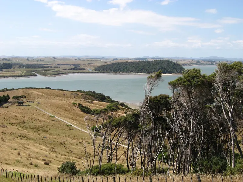
Photo: “Atiu Creek Regional Park - Oruawharo River” by Lee Taylor, CC BY 2.0, via Wikimedia Commons
Park at a glance
- Region
- Auckland
- Location
- Tapora, Kaipara Harbour
- Managed by
- Auckland Council
- Dogs
- No dogs
- Camping
- Yes, see Camping section
Overview
Ātiu Creek Regional Park covers a peninsula on the Kaipara Harbour, on the quiet Tapora side of Wellsford. Jackie and Pierre Chatelanat gifted the farm to the former Auckland Regional Council. They wanted every New Zealander to be able to reach the Kaipara, and they wanted the area's cultural and heritage values protected.
More than a third of the park is mature and regenerating forest. Large kauri, tōtara, pūriri and pōhutukawa grow on the ridges and along the coast, mixed with older plantings of cypress, cedar, Norfolk pine and redwood. The rest is working farmland, so expect to walk through paddocks with cattle and sheep.
Getting there and opening hours
- Address: 414 Run Road, Tapora (about 10 minutes from the Stables Landing boat ramp, back toward Wellsford)
- Vehicle gate: 6am–9pm during daylight saving and 6am–7pm the rest of the year
- Road: Sealed to the park entrance. The last 1.3 km to the main car park is unsealed, and so is a further 3 km to the campground.
- Parking: About 25 cars, with overflow parking on grass in dry weather
Walks and tracks
| Track | Time | Distance |
|---|---|---|
| Ti Tree Point Trail | 15 min | 1 km |
| Clearfell Track | 45 min | 1.8 km |
| Reservoir Walk | 2 hr | 5 km |
| Oruawharo River Trail | 3 hr | 7.8 km |
The formed farm roads work for off-road prams, but some sections are steep and a few gates have no ramp. All-terrain mobility equipment can get around much of the park.
Things to do
Horse riding
Ātiu Creek has extensive horse trails across mixed terrain: farmland and native and exotic forest. Groups are limited to 20 riders, and riders must stay on the designated trails. Riding is closed over winter and early spring because of wet ground. The council planned to reopen it on 16 October 2026 if ground conditions allow, so check the park alerts before you float your horse up.
Birdwatching
Fantails, grey warblers, kererū, ruru (morepork) and tūī live in the forest. Banded rails, fernbirds and white-faced herons use the salt marsh. The reservoir draws black swans, pāteke (brown teal) and NZ dabchicks.
You can surfcast from the headlands between Solomon's Bay and Mullet Creek, but only around high tide, because mudflats stretch out hundreds of metres. The council advises against kayaking, boating and diving here: the coast is very tidal and the currents are strong. The park also has a 40-marker orienteering course and mountain bike tracks.
Dogs at Ātiu Creek
Dogs are prohibited at all times everywhere in the park, on the foreshore and on the adjoining estuary. The ban includes dogs left inside vehicles.
Camping and places to stay
Bookable stays include the Ātiu Creek campground, a CSC overnight parking area, Ātiu Cottage and the Courtyard House. Treated drinking water is available at the campground taps. Mobile coverage is patchy.
Where is Ātiu Creek Regional Park?
The pin marks: Centre of the park area (-36.3313, 174.3654). It isn't an entrance or car park, so check the council's park page for access points before you go. Plan a route on OpenStreetMap (opens in a new tab).
Location data: Auckland Council Park Extents (CC BY 4.0); OpenStreetMap contributors (ODbL 1.0).
Check before you go
Track closures, gate times, fire bans and storm damage change often. Auckland Council posts current alerts for Ātiu Creek Regional Park on its official park page.
Current park alerts