Te Ara i Tautahi / Ambury Regional Park: Auckland's City Farm
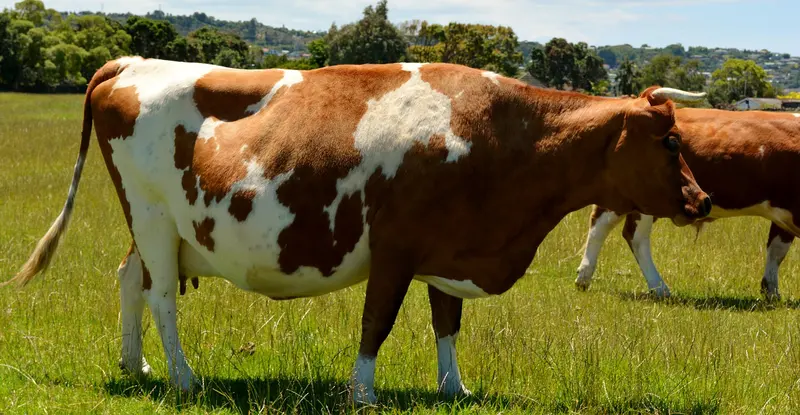
Photo: “Ambury Farm Mangere,Auckland NZ.” by GPS 56, CC BY 2.0, via Wikimedia Commons
Park at a glance
- Region
- Auckland
- Location
- Māngere Bridge, South Auckland
- Managed by
- Auckland Council
- Dogs
- Dogs in some areas
- Camping
- Yes, see Camping section
Overview
Te Ara i Tautahi / Ambury Regional Park is a working farm park on the Manukau Harbour shore at Māngere Bridge. It's a short drive from central Auckland, so it's one of the easiest regional parks to reach from the city. Families can wander lanes between the animal enclosures, walk the harbour foreshore and see daily farm jobs like milking and lamb feeding.
The Māori name comes from Tautahi (Sirius), a bright star that Waiohua used to time the planting of kūmara. Tautahi was also part of a star path to Matariki. The foreshore is an important shorebird habitat and shows old basalt lava flows. Birdwatchers have recorded more than 86 species here.
Getting there and opening hours
- Address: End of Ambury Road, Māngere Bridge
- Vehicle gate: 6am–9pm during daylight saving and 6am–7pm the rest of the year. The automatic gate always opens for vehicles leaving.
- Walk-in access: 24 hours
- Parking: 20 spaces in the main car park (four mobility parks), plus overflow grass parking
Walks and tracks
| Track | Time | Distance | Suitable for |
|---|---|---|---|
| Family Farm Walk | 45 min | 1 km | Prams and wheelchairs |
| Lost Gardens Walk | 30 min | 1 km | Mountain buggies |
| Foreshore Walk | 45 min | 2 km | Mountain buggies |
| Ambury Mountain Bike Route | 45 min | 2.5 km | Bikes and walkers |
| Māngere Foreshore Path | 90 min | 14 km | Longer coastal walk or ride |
The Family Farm Walk is the most accessible route. The farm lanes are gravel and grass and can be hard going when wet.
Things to do
Meet the farm animals
The farm has sheep, goats, cows, pigs, chickens, turkeys, rabbits and peacocks, plus pet lambs in season. Grassy lanes run between the enclosures, and where signs allow you can go into paddocks to mingle with the animals. Paddocks are closed to visitors during lambing (mid-July to early August). Please don't feed the animals.
Milking and lamb feeding
From mid-July to early December you can watch the cows being milked at about 9.45am. On weekdays school groups get priority at the milking shed. Orphan lambs are usually fed from early August to the end of September: at 8am and 4pm on weekdays, and at 8am, noon and 4pm on weekends. Times can change, so call the ranger on 09 301 0101 on the day.
Birdwatching on the Manukau
The Manukau foreshore is a significant shorebird habitat. Volunteers from the Friends of Ambury Farm and Foreshore help with pest control to protect the birds. The lookout paddock has views across the Manukau Harbour to the Waitākere Ranges.
Horse riding is run through the Mangere Pony Club, which holds a council licence. The park has electric and wood-fired BBQs, picnic tables and a shelter. The Felt Room, which holds up to 30 people, can be hired for children's parties on weekends and in school holidays.
Dogs at Ambury
Dogs are prohibited in almost the whole park. That includes the campground, stock paddocks, the farm, foreshore and Lost Gardens walks, and the Watercare Coastal Walkway. The only place you can walk a dog is Loop Road, an 800 m fenced road between Kiwi Esplanade and Ambury Road, with dogs on a leash.
Camping
The Ambury Campground is in the city, so it suits campervan travellers who've just arrived at Auckland Airport. It's bookable through Auckland Council, along with a certified self-contained (CSC) overnight parking area. Dogs aren't allowed at any bookable site.
Good to know
- Drones are not allowed.
- The park is smokefree and rubbish-free, so take everything home with you.
- The Felt Room is unavailable from 17 July to 24 August 2026 for lambing.
Where is Te Ara i Tautahi / Ambury Regional Park?
The pin marks: Centre of the park area (-36.9485, 174.7660). It isn't an entrance or car park, so check the council's park page for access points before you go. Plan a route on OpenStreetMap (opens in a new tab).
Location data: Auckland Council Park Extents (CC BY 4.0); OpenStreetMap contributors (ODbL 1.0).
Check before you go
Track closures, gate times, fire bans and storm damage change often. Auckland Council posts current alerts for Te Ara i Tautahi / Ambury Regional Park on its official park page.
Current park alerts